|
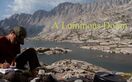
Friday, May 6, 2016 It has been just over a month since day 10. I am camped in a dirt parking lot just off the Palms to Pines highway, across the street from where Lindsey picked me up to go to the Paradise Valley Cafe. It is about 1:30am, and it is good to be back. My friend Brian dropped me off a few minutes ago. We had to do some funky car swapping, because he plans to join me tomorrow evening and hike with me on Sunday. My car is parked where the trail crosses Interstate 10. He picked me up there, dropped me off here a couple hours later, and drove back home to go to work. He was delayed a couple hours from our planned meeting time because there was a police standoff on the freeway that he would have used, and traffic being what it is, most of Southern California shut down as a result. He’ll drive up and meet me at Fuller Ridge tomorrow evening (Saturday), and then we’ll hike down to my car, drive back up to his car, and each go our merry way back to our homes. It’s a complicated plan, but it’s also ambitious. Fuller Ridge is 20 miles away from my car, about 35 miles from here, and I also plan to summit San Jacinto on an alternate trail that adds about 5 miles. So, twenty miles a day. Luckily, I’ve been training. Oops, never mind, no I haven’t. Right now, though, I’m lying in my tent in a dirt parking lot, startling awake at every sound as if it’s the first time I’ve ever been camping. It’s mildly windy, and I’m close to a highway, so there are a lot of sounds to wake me. At 6:45, I wake up to the light and try to decide whether to get up or get some more sleep. This decision takes me thirty minutes. I am dead tired, but I finally decide to get up. I break camp and hit the trail by 7:45. The desert that I remember from a month ago is already changing to a more mountainous type of desert in less than a mile. Boulders and yucca are interspersed with larger bushes and occasional oak. It is strange to have a trip connected mile to mile and so disconnected by taking a month-long break, and I worry that I may have already lost a bit of the experience of thru-hiking by breaking it up like this. 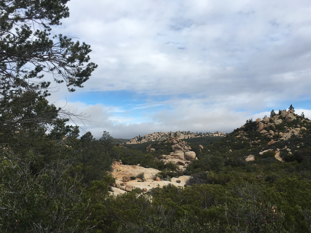 After about an hour of hiking, I come across a couple hikers standing near a tent. A young lady and an older man. The tent is open, and has another young lady sitting inside it, sort of packing up, but not accomplishing much. The man greets me and then continues to hold us all captive for twenty minutes, telling us all what we should be expecting in the next section. At first I think he must have done this section before, but it turns out he’s just a classic know-it-all. I decide I’ve had enough, and tell him I have to get moving. I stop a while later on a large flat rock overlooking the trail and make breakfast. Oatmeal. The trail comes up a shallow wash here, and the young lady from earlier hikes along it and then disappears. When she reappears and reaches me, I joke that she got lost along the way, and she looks at me funny. At first, I think that she doesn’t speak english very well—she has an accent that I can’t place. Then I realize that she probably left the trail to go to the bathroom. Poor joke. We make small talk about our packs—a larger version of the Z-Pack arcblast, and wants to know if mine is getting worn through on the bottom like hers is. It isn’t. I learn that her trail name is Sugar Rush, because she raced to Julian for the pie. The other girl in the tent has been her camping buddy for the past few days, but they usually don’t hike together, they just meet up in the evening and set up camp near each other. She continues on, and I finish my breakfast. The trail continues to wind among the boulders and scrub brush. Occasionally a fire road passes by or crosses the trail. Big puffy clouds cross the sky, but it is mostly sunny, if a bit windy. I pass Sugar Rush again and we hopscotch for about an hour before I leave her behind on a steep uphill. The trail climbs the ridge for a while, and I remember that a previous thru-hiker told me there was a great place to camp up here, where you can see the lights of palm springs in the distance. But it’s only 10am. Maybe I can come back here some day. 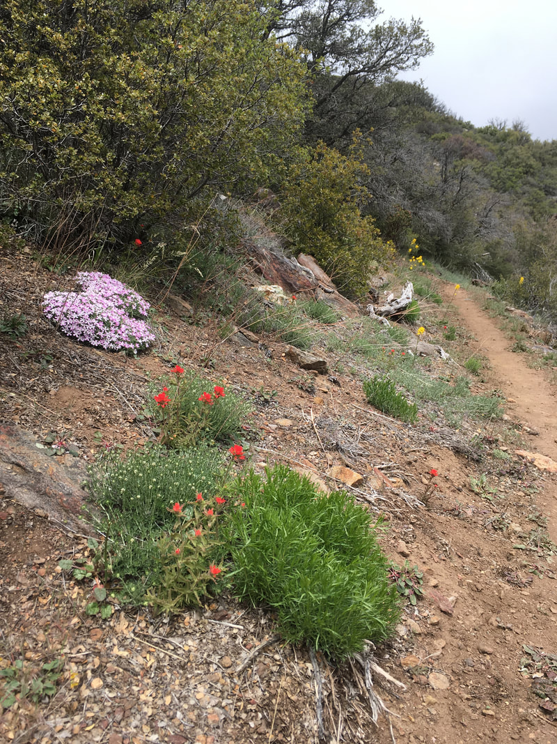 I’m glad I decided to hike this section. Because of a fire closure coming up, I’ll have to do a long walk-around called the Halfmile alternate. Halfmile is the trail name of the guy who created the alternate, not the distance of the alternate. It’s more like twenty miles. All this uphill gain that I’ve accomplished today will be lost in a long series of descending switchbacks, followed by a road walk, and another long uphill climb. Many thru-hikers decide to skip it for this reason, but it’s pretty here, and I’m glad I didn’t miss it. 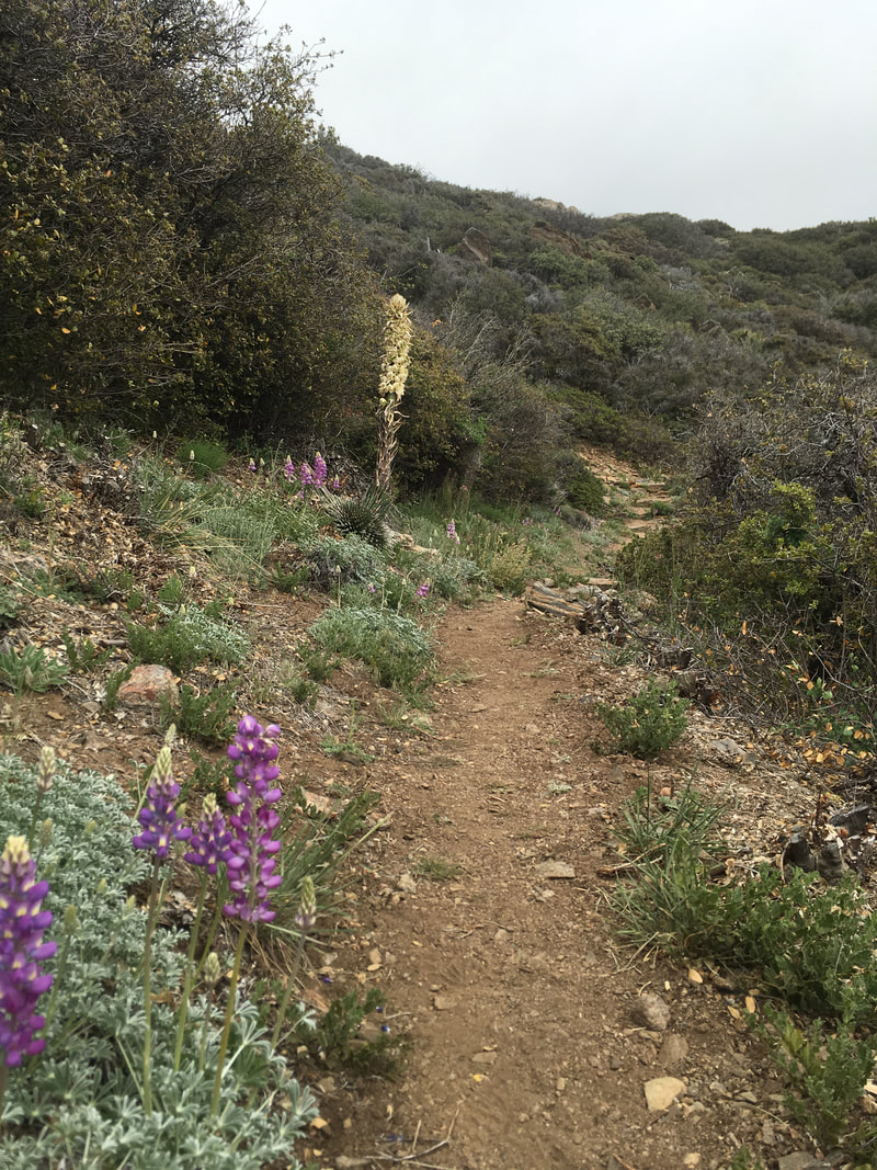 As the ridge line climbs higher, the wind picks up, and then it starts to rain, snow and sleet, all at once. It looks like it’ll be short-lived, so I don’t bother to get out my rain gear, but the weather lasts just long enough to soak my clothes and make me clammy. The clouds stay put, and the grass and small plants that line the trail keep continue to paint my legs wet. I reach the Cedar Spring turnoff—where I’ll leave the official PCT and start the long downhill—and I hear voices ahead. They are coming from the closed section of trail. I wonder if these are hikers who ignored the closure. I decide to take a break before I head down the switchbacks to Cedar Spring. A moment later, I have my answer—two men come out of the bushes wearing hard hats. One is emblazoned with a forest service logo, the other with a PCTA sticker. They have been checking the trail for restoration to decide whether it will be safe to reopen it soon. Too late for me, though; I’ll have to hike around. I take the long downhill at a trot. It’s hard on the knees and feet, but easy on the cardiovascular, and the long grass continues to wet my legs and keep me cool all the way down. I take another break at Cedar Spring, refill water and snack on peanut M&Ms. It seems like the sort of place that should have a picnic table: big tree, lots of grass, trickling water. Showers continue intermittently, and I break out the rain gear.  The trail emerges onto a paved road, but I’m not on the PCT anymore, so there are no signs to tell me where to go. I check my maps—it’s the first time I’ve really needed them—and turn left. Around a turn is a forest service truck, and the hard-hatted men are climbing in. I’m tempted to ask for a ride, but I’m not ready to give up just yet, no matter how tired I feel. Speaking of which, I’ve only hiked about 13 miles so far today—why am I so tired? The road meanders gently for a while. In a car, I love this kind of road. It’s the sort that takes you to hidden places, and where you feel like you’re passing through wild unmapped lands. But on foot, each step is like a hammer pounding upwards on my feet. I feel it through my knees and hips, even up through my back. I check my maps religiously, because there should be a turnoff coming soon. I almost miss it, because it looks like a gated road to private property. In fact, there is a sign that says private property, but there’s also a forest service sign and a small gate for foot traffic. I start down a dirt road strewn with fist-sized stones. At first it’s level, but after a mile or two, it starts to descend sharply. The rain continues on and off, and the road is either pavement-hard, ankle-busting rocks, or slick mud beneath my feet. I have views to a large meadow below, speckled with aspen and fir. The palms to pines highway cuts across it, southeast to northwest, and I can see two to three matchbox-sized cars passing through at any time. As I slide down muddy road, pound my knees into tractor-compacted dirt, and slip on stones, by knees and feet begin to really hurt. I take a few more breaks, but they don’t do much except give me a reprieve. The downhill seems endless, but I do finally make it to the basin, and the ankle-turning rocks disappear. Up ahead I see Sugar Rush. I wonder how she got ahead of me! I don’t find out until we reach the highway, where she is trying to figure out the next step on her map. It turns out that she missed the turnoff to the private road, and her walk ended up being shorter. We cross and start walking down the highway together, chatting in the rain, which is steadier now. A woman in a car stops to ask if we want a ride to the Hemet market, but the rain is sort of pleasant now, and after that long uncomfortable alternate, we’ll be damned if we’re going to start skipping sections now. We thank the woman, but walk the last few miles to the market.
The market has a nice patio with metal tables and chairs, but they are all chained up, so four or five hikers sit under the eaves against the wall. I go inside and get a large bottle of beer and a candy bar and go back outside to shiver with the other hikers. Sugar Rush’s friend shows up a moment later: she hitched the last few miles of road. We all talk for a while, and they decide to try to hitch up to Idyllwild instead of hike the rest of the fire closure. Less than a minute after that decision, a man comes out of the store and asks if any of us want a ride up to Idyllwild. They take the ride, and I opt out. I know it’s a really common section to skip, and it’s not officially the PCT anyway, but I don’t feel right about skipping it. After they leave, I finish my beer, use the restrooms, and hobble down the road. The rest has given my joints and muscles time to stiffen, and the pavement is painful. It’s a rainy half mile to the campground, and the other hikers are already napping in their tents when I arrive. I make dinner and turn in early. It’s only 6pm, but I have hiked 21 miles. I’m tired, I hurt, I'm cold, I'm soaked through, and I’m also strangely satisfied.
0 Comments
Your comment will be posted after it is approved.
Leave a Reply. |
Author
Nick is a teacher, writer, and amateur adventurer. Archives
June 2020
Categories |
 RSS Feed
