|
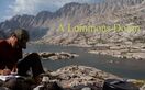
June 29, 2016 811.3-831 (+3) I’ve camped near the King’s River once before, when I hiked the John Muir Trail in 2008. This night, like that one, was one of the coldest nights I’ve ever spent in the Sierra. I had to force myself out of the sleeping bag. The river was already flowing deep and wide, not a good sign for those poor souls who would be crossing later in the day after snow had had a chance to melt and funnel into the river. I had to search upriver a bit, but I finally found a large Douglas Fir that had fallen across the water and was mostly bereft of branches. Balance was a little more difficult with cold, stiff muscles. Crossing logs is one of my favorite wilderness experiences, but I prefer to feel limber and quick. Nonetheless, I made it across safely and climbed out of the river’s funnel. 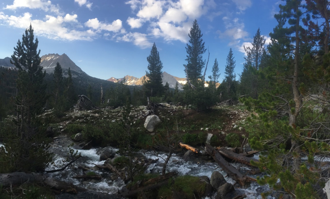 The climb back up was a little longer than I remembered, but soon enough I was among stunted foxtail pines on a basin plain with wide views. To the east, a line of burnt ember ridges hinted at iron ore. To the north, Mather Pass loomed. I stopped at a granite bench that was polished and shattered by ancient glacial activity, puzzle pieces of rock that had been loosely arranged in order. I filtered water, then watched the shadows migrate along the eastern wall as the sun climbed over the peaks. The cold had me chomping at the bit, so I packed up quickly and charged ahead without checking my rest site. That would bite me in the ass later, when I realized that my water filter was missing. The trail followed a tributary of the Kings River through the basin plain. Meadows and polished granite alternated to create a mottled landscape for several miles. Morning mists hung about the nearby peaks. Their nearness reminded me that I was hiking a catwalk in the sky, and my spirit elevated. 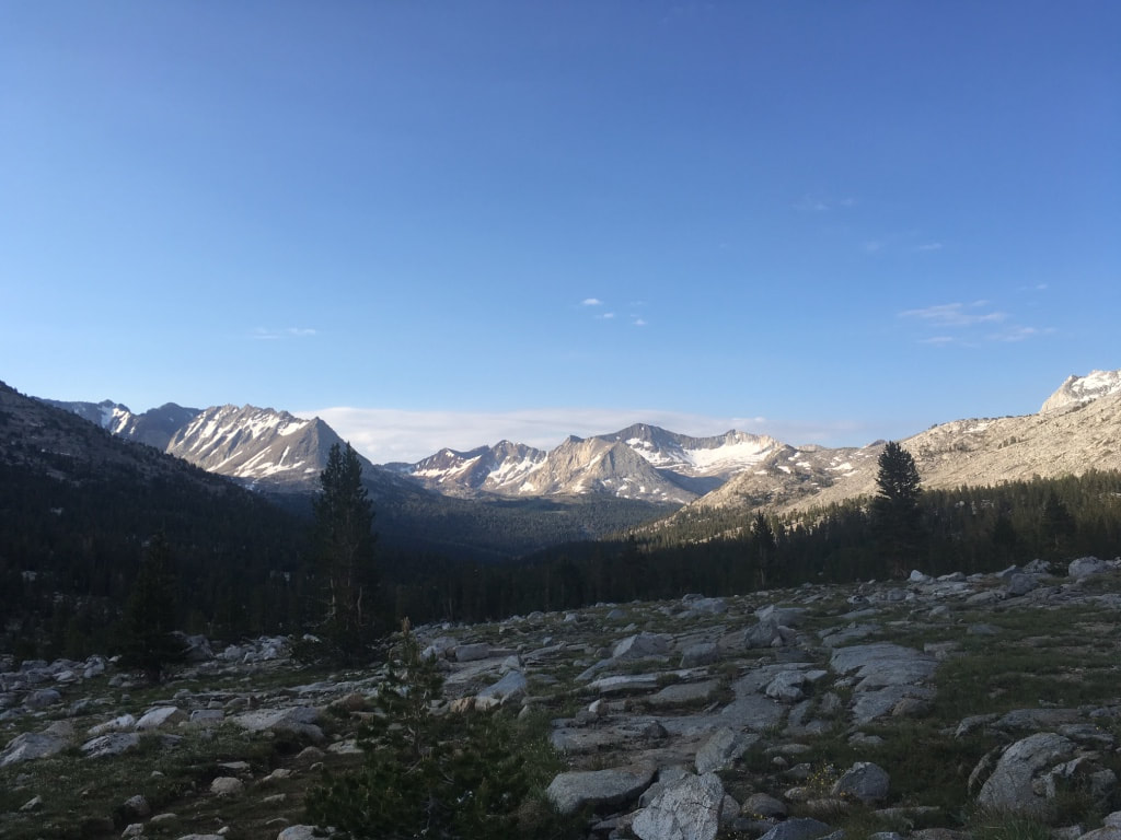 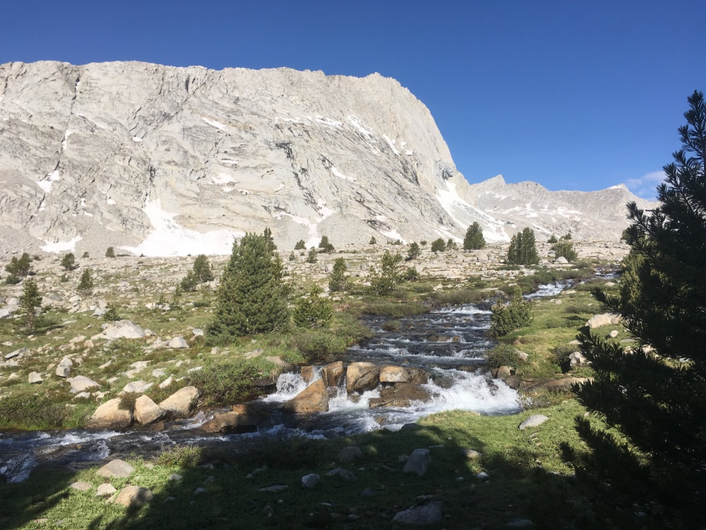 I passed several hikers going in both directions. The southbounders were almost certainly hiking the John Muir Trail or some other shorter hike. It was too early in the season for PCT SOBOs. The northbounders could be either PCT or JMT hikers, but it was usually easy to tell them apart. PCT hikers usually looked stretched out and underfed, their clothes had inexplicable stains, and their gear was scuffed and frayed. JMT hikers generally had bigger, heavier packs, and everything about them looked clean and nourished. I passed one such NOBO hiker in the late morning, and asked him if he was hiking the JMT. He scoffed. “No, I’m doing the PCT.” I felt bad. “Sorry, you look so clean.” He chortled and introduced himself as Golden Girl. By this point I had stopped asking hikers how they got their trail names, but I wish I had. The gently sloped terrain made it easy to crush miles, and I quickly found myself climbing Mather Pass. On my SOBO JMT trip in 2008, Mather Pass was the hardest pass we climbed. That day, as I remember, started with the Golden Staircase, which spent most of our energy. When we reached the top of that, we started into Palisades Basin, a long, curving ascent from which Mather Pass is visible for entirely too long. It seemed we would never reach the end, and we spent most of the afternoon cursing “Fucking Mather Pass”. By the time we finally reached the top, we were almost delirious from exhaustion and found the phrase so hilarious that we took pictures of each other humping the boulders that marked the top. I chuckled at the memory as I hiked up and around the lake and attacked the switchbacks. 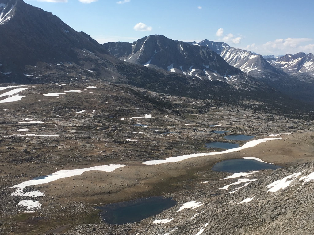 When I reached the top, I found a lanky young man (stretched, dirty, and undernourished—definitely a PCT hiker) taking photos of Palisades basin below. The top part of the basin was covered in snow crisscrossed by footprints and glissade tracks. The young man was called Tinman, and he asked me to take a picture of him with the basin in the background. I obliged and asked him to return the favor. The three pictures he took, all of them, prominently display the edge of his finger. “Isn’t this breathtaking?” I said, “I think this is one of the most beautiful places on the planet.” “Nah, you can find this in any country that has mountains.” Okay buzzkill. 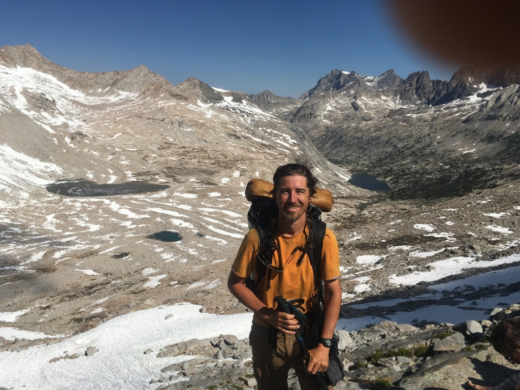 He asked to look at my maps. He told me he had dropped his phone in a river and hadn’t brought any paper maps, so he wasn’t really sure where he was. I showed him and helped him find his next resupply point, then we both started down the snowy slopes. I took a short glissade just for fun, but the snow was too soft and I couldn’t go very far. A while later I found myself descending through the paradise of Palisades Basin. Water cascaded down emerald slopes. Below, the azure Palisades lakes shimmered. Somewhere, a wood recorder was playing faerie music. I turned a switchback and saw the source, a young hippie sitting crosslegged, enchanting the basin with his improvisation. I wanted to sit and enjoy it, but I knew the music would stop and I would be expected to talk, so I just drank it in as I passed. 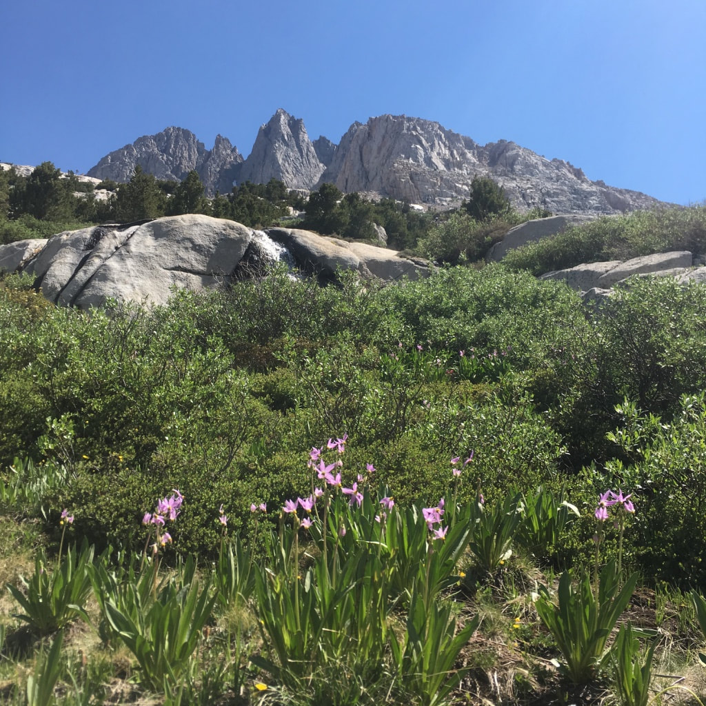 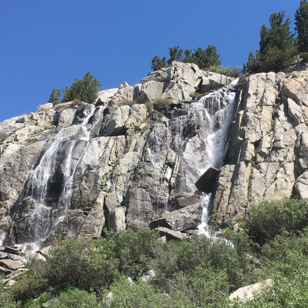 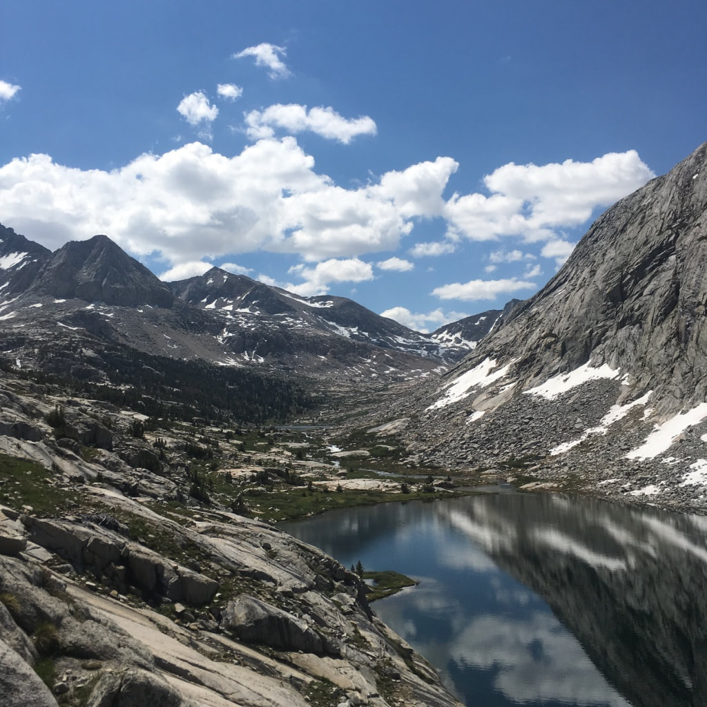 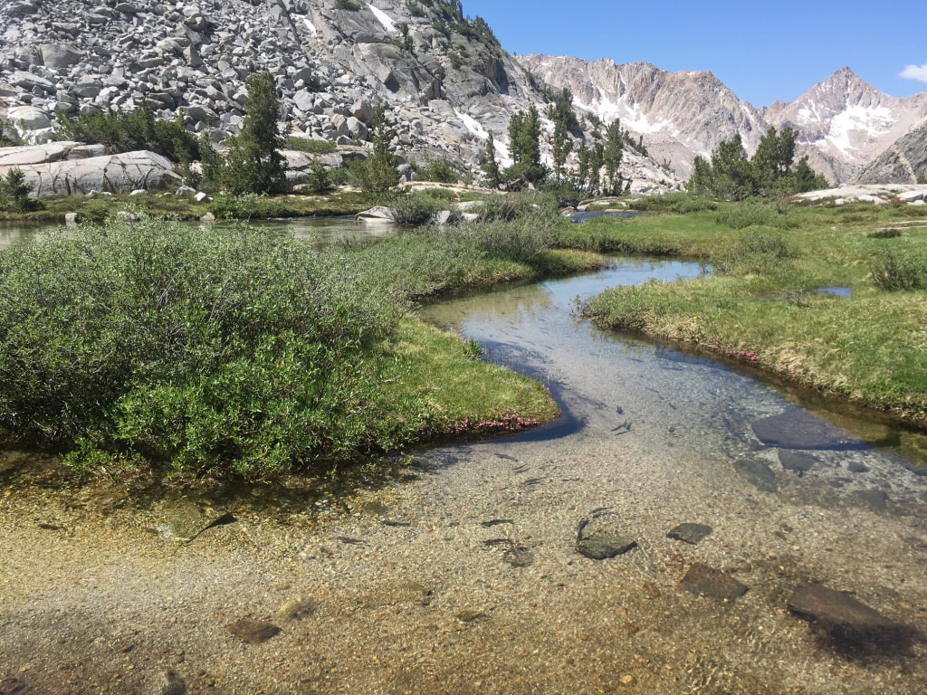 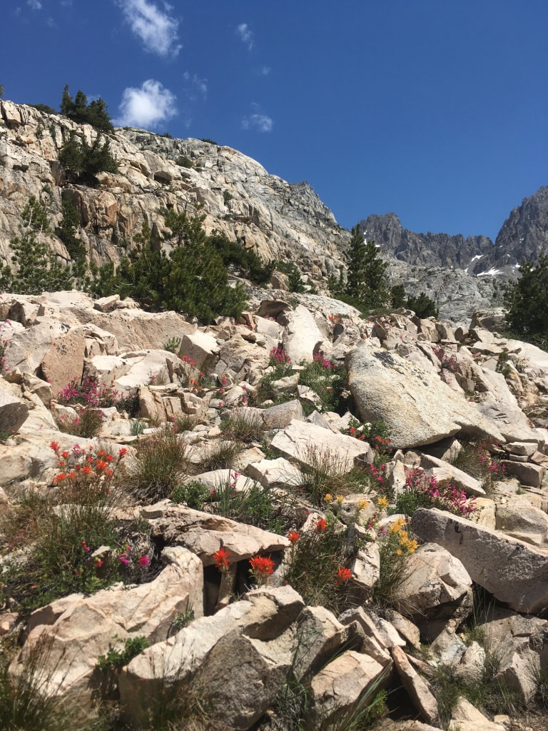 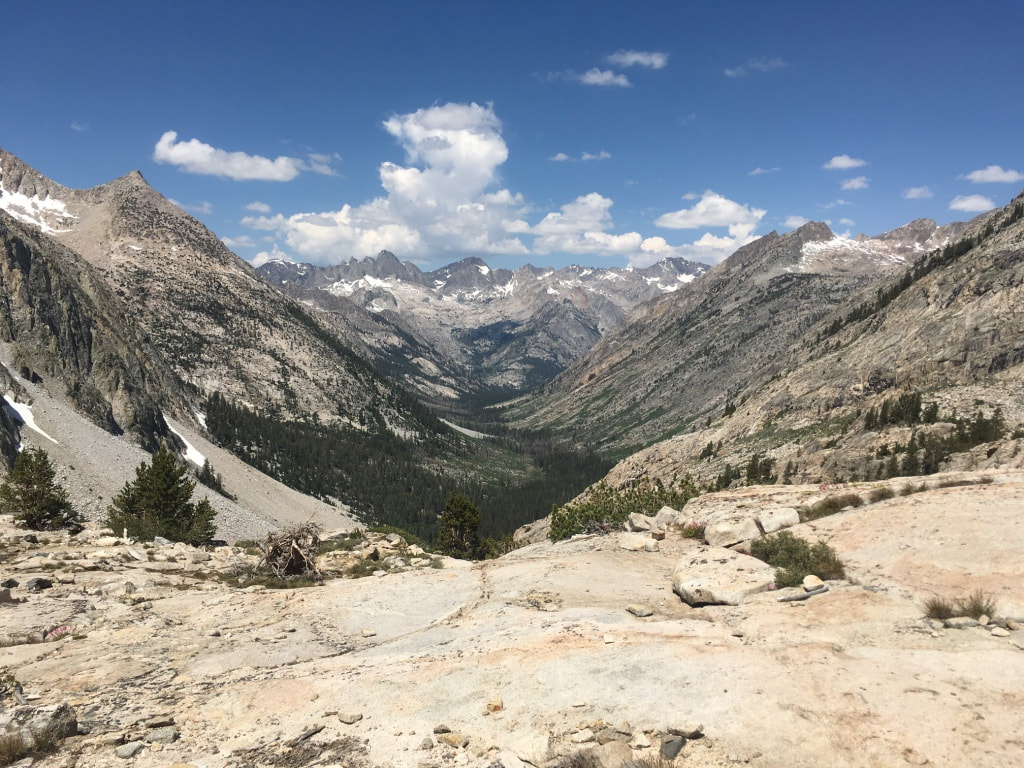 I exited the Palisades and began my descent of the Golden Staircase. It was crawling with people, most of them headed uphill, and many of those resting in the scattered shady nooks between exposed switchbacks. I empathized. I remembered how grueling that climb had been and was grateful that I was now headed downhill. Eventually I reached the bottom, knees aching, and followed palisade creek along the canyon. I found a shady campsite near the river to eat lunch. When I went to pump water, I realized I had lost my filter. Not a disaster, but a bit of a bummer. I had aquamira drops as a backup, so now was as good a time as any to try them. Maybe I could just ditch the extra weight and use the aquamira from now on. I added a few drops to my Smartwater bottle caps and settled in to read some Nabokov while I waited for the chemicals to work their magic. Some deer strolled through camp and I stopped reading to watch them instead. 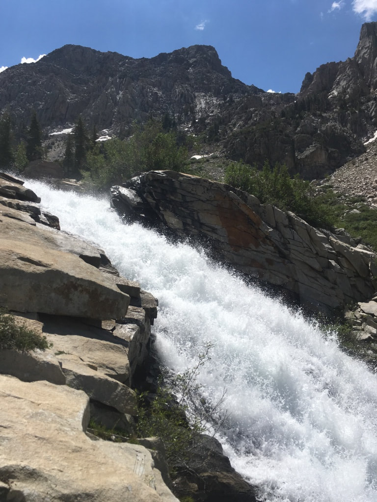 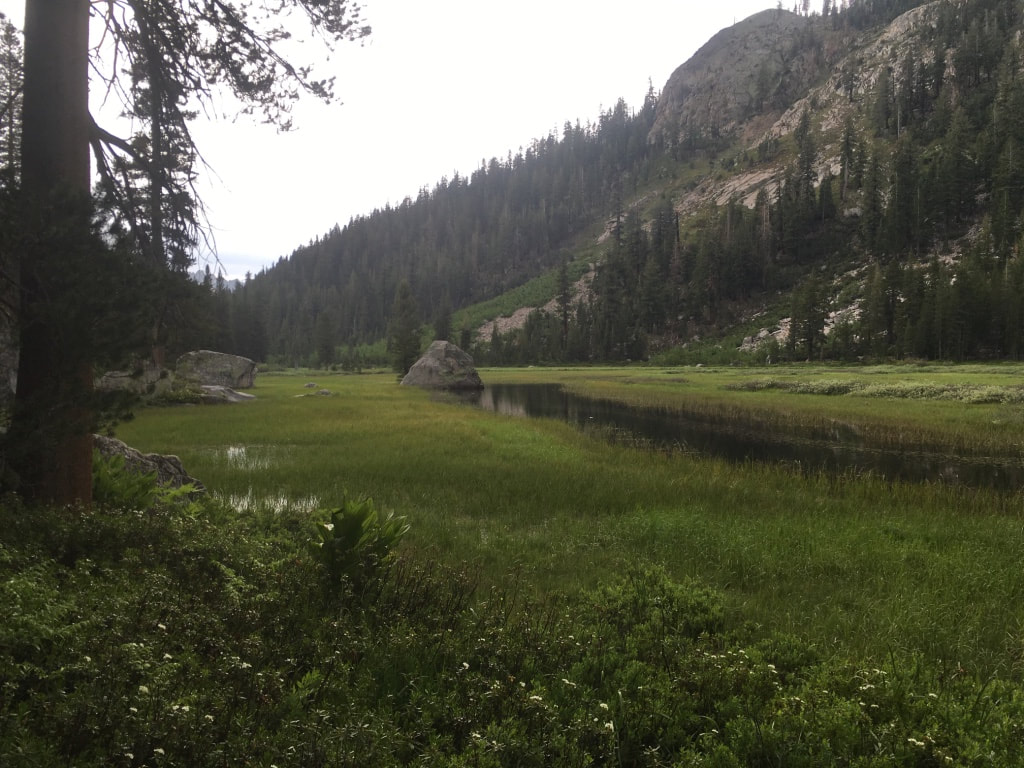 After lunch, the trail turned up the middle fork of the Kings river through . It was roaring. Where the river plunged over a couple of 10-foot drops, I threw a pine cone in to watch it surf the rapids. I’ve always been fascinated with the way water moves, with its power and flexibility and beauty. I stood and watched it for as long as my attention would allow. By the time I finally reached my turnoff to Dusy Basin and Bishop Pass at PCT mile 831, I was exhausted. I decided to continue on “just a little bit further”. That ended up being a 3600 foot climb over 3 miles of switchbacks. By the time I reached Dusy Basin I was so drained that it was difficult to set up my tent. I would push in a stake and nearly black out when I stood up. Finally, though, I got the tent set up, made dinner, and surveyed my surroundings. The basin was from a world of dreams. A calm, shallow waterway meandered so calmly through the alpine grass that it seemed without direction. Trees were sparse, small, and twisted like bonsai. Marmots loped across the grass without concern. The whole impression was of unspoiled innocence. As I lay down beneath the sunset alpenglow of the Inconsolable Range, two deer drifted by and carried away the last of my consciousness.  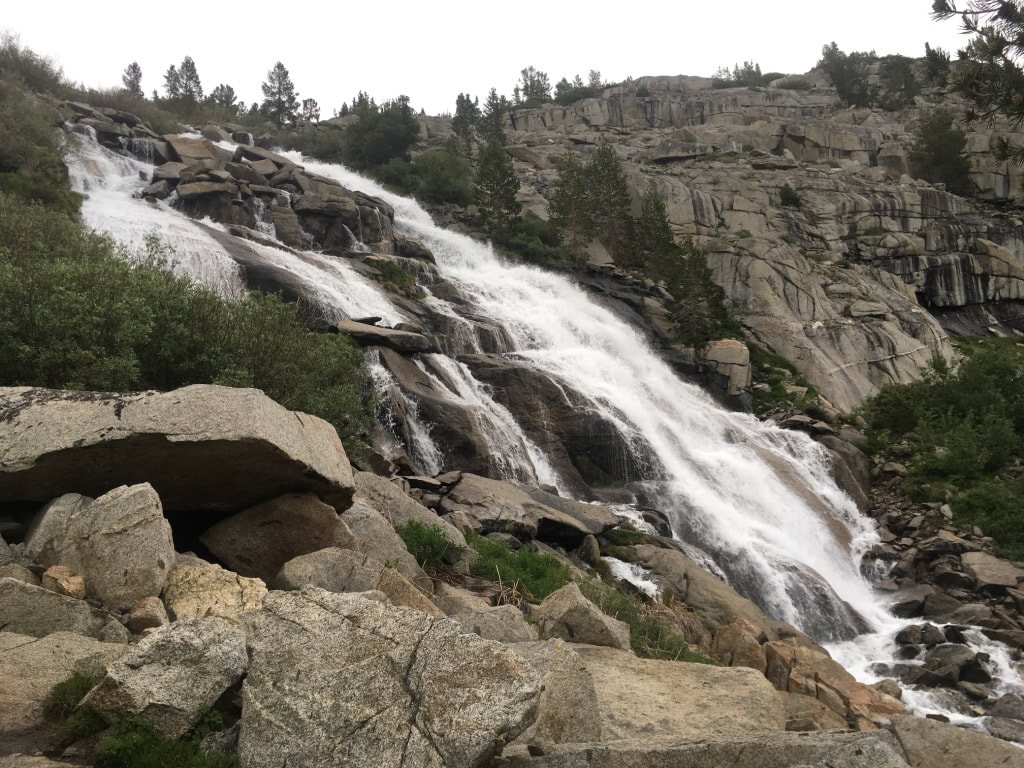 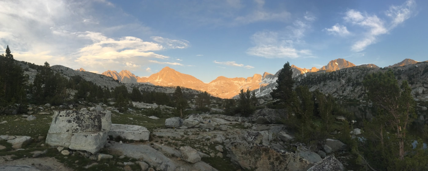
0 Comments
Your comment will be posted after it is approved.
Leave a Reply. |
Author
Nick is a teacher, writer, and amateur adventurer. Archives
June 2020
Categories |
 RSS Feed
