|
May 28, 2016 The morning is leisurely. The sun is up before we make breakfast and it’s 7:30 before we break camp. The wind has died down, and all is stillness except for the quiet lizards that lie on every rock like pendants. We start to meander down, and the baking sun swiftly rises and dominates our thoughts. After an hour, I can feel the heat of the earth through the soles of my shoes. The switchbacks are slightly different now. They cut twice around a curve in the mountain, a gulley on the inside, an outcropping on the outside. The dirt is interspersed with shale, especially near the gulley, and the hard angles press into my feet. The outside turn has a steeper drop-off, and we begin to look below for the trail, hoping for a shady spot to stop. There is none. After two days of hiking down this mountain, we are so close to the bottom it seems like only a couple more switchbacks should do it, but it is another hour before we finally reach the last, long switchback. 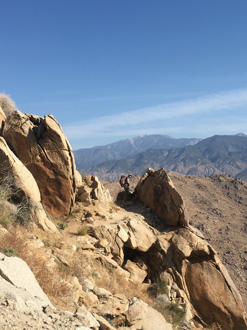 We turn away from the mountain, and it is a relief worth celebrating. We climb up over a large rusty aqueduct pipe and follow the sloping trail to a water fountain next to a large boulder that provides shade. Sweet relief. We stop and take a longer rest, filling our water bottles and occasionally waving away a yellow jacket or two. They aren’t aggressive, just curious and looking for water. It’s hot, even in the shade, and before we use the drinking fountain to soak our shirts, hats, and bandannas. We start down a small asphalt road, really more of a wide sidewalk than a road, and I look for snakes. Reading trail journals from previous years, I had come to expect that there would be a snake every few days in the desert, but so far, I haven’t seen one, and to be honest, I’m a little disappointed. Before five minutes have passed, the only water left in our shirts is our sweat, and even that is evaporating fast. The heat from the asphalt radiates up at us. We come to a little village of houses, seven or eight of them arranged alongside the road, and a few shady trees. Each house has its own kitschy decorations, but the first one has a signpost with styled woodwork pointers in all directions. The two most important, of course, point to Canada and Mexico, and give the mileage along the PCT to both. It’s a little thing, but it boosts the spirit to see that someone cares about the adventure we’re on, and that all the hikers coming through are not just an annoyance or inconvenience. It takes less than two minutes to pass through the entire community, and there are no signs that anyone is around. We are back in the desert frying pan. Even the vegetation smells like it is baking. We pass under crackling power lines, and later, a creaky windmill. There is some wind here, but it feels more like someone is standing next to us, breathing hot air, than like a breeze. The trail is white sand. There is only a mile left until the trail crosses under the interstate, but we are both struggling in the heat and we need shade sooner than that. We sit under a tall bush and guzzle hot water from our bottles. The heat brings out a metallic flavor, but my body needs the water. I text Brian to see when he and Jon are scheduled to arrive. About an hour. 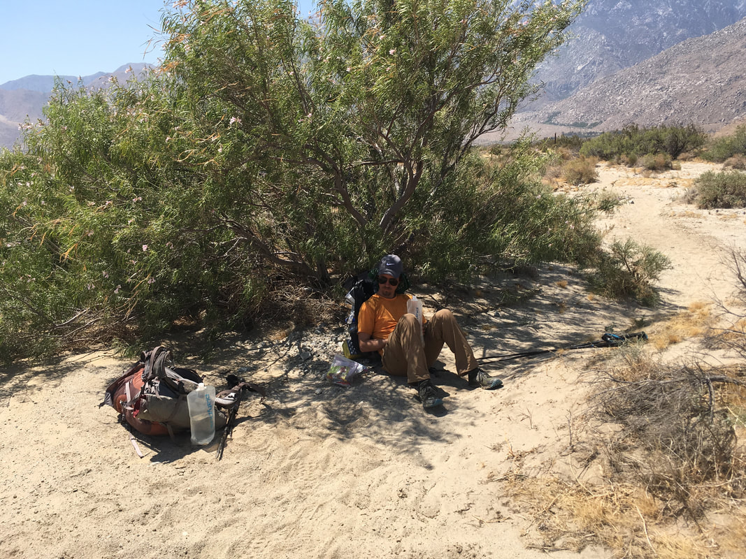 We enter a large, wide wash, and turn left. We are close to railroad tracks, and beyond those, the interstate. We can hear the swish of cars and the occasional rasp of trucks violating the rumble bars, but they still sound distant. A train snakes along the side of the wash as we approach. The trail has devolved from a clear path into a general direction, and every step is an effort in the loose sand of the wash. But it doesn’t take us long before we reach the shady relief of the interstate. We cross under and wait for Brian and Jon on the far side. 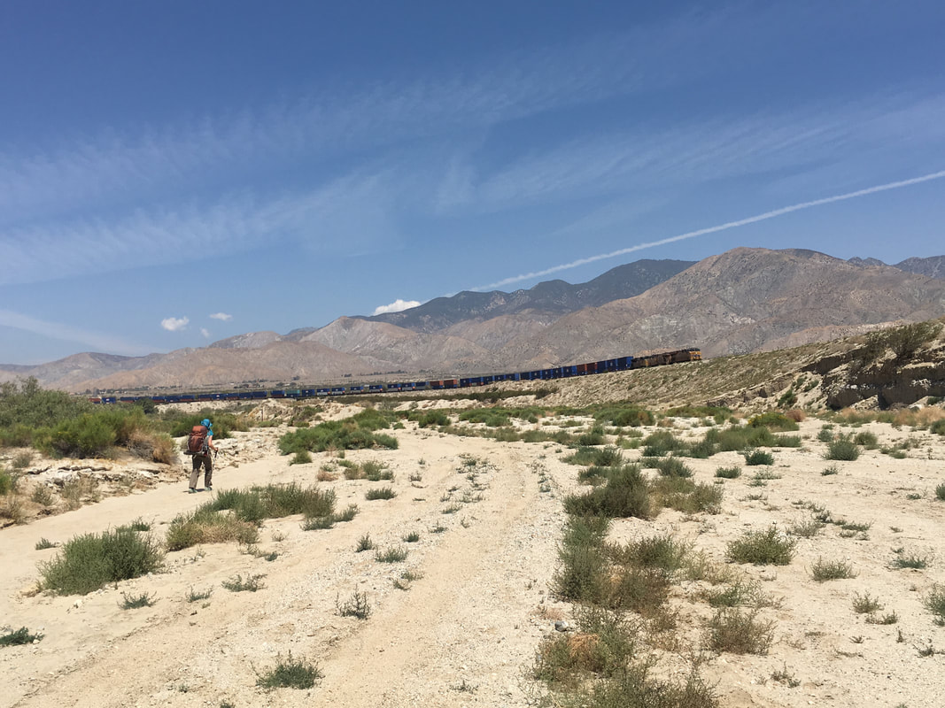 They show up about ten minutes after we arrive. Hugs all around, and then we climb into Brian’s jeep and head off to lunch at BJs. I ask the hostess to seat us away from everyone else if possible, because Lindsey and I stink, and we know it. After lunch, we all drive up toward Onyx Summit, which is the end of the fire closure. This means I’ve had to skip about 40 miles of the PCT now. I make mental plans to return some day, maybe this summer if they open it by then. The drive up is winding and pleasant. After a big meal and a couple beers, Lindsey and I are lulled into short catnaps on the way up the mountain. Each time I awaken, it is to a sweet flowery perfume. The road is lined with bushes of yellow flowers. The smell is heavenly. We arrive at Onyx Summit and park the jeep in a dirt lot with several other cars. It takes Brian and Jon about ten minutes to get everything together, then we all march up through pine trees along a dirt road to the trail. It is blessedly cooler here. About a half hour into our hike, we come across a couch in the woods, and next to it, a decorated dumpster painted with the word “Magic”. Inside is a trail journal, sodas, and cookies. Brian wants to keep moving, but this is the first real trail magic of the trip, and I can’t pass up an experience to sit on a couch in the woods. We only stay about ten minutes, but then Lindsey realizes that she left her glasses in the jeep. She’s been wearing prescription sunglasses so far, but she’ll need her regular glasses when it gets darker. I borrow the keys from Brian and go with Lindsey back to the Jeep while Brian and Jon stay with the packs. When we return, we decide to sneak up on Brian and Jon. Instead of the trail, we follow a dirt road that has been paralleling the trail the entire way. I grab a couple rocks, and when we get close enough, I lob one of them toward the garbage bin. The first one misses, but the second one clangs off the side. Brian says “what the…?” and looks around for us. 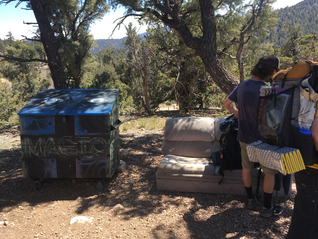 The glasses crisis averted, we continue down the trail toward our camp. It is a gentle downhill for most of the way, and the forest is open and relaxing. When we arrive, Brian wants to continue hiking; they have only hiked four miles today. Lindsey and I have only hiked thirteen miles, but the desert heat has taken it out of us, and we are tired. We all have a nice relaxing evening, playing cards and chatting over dinner. 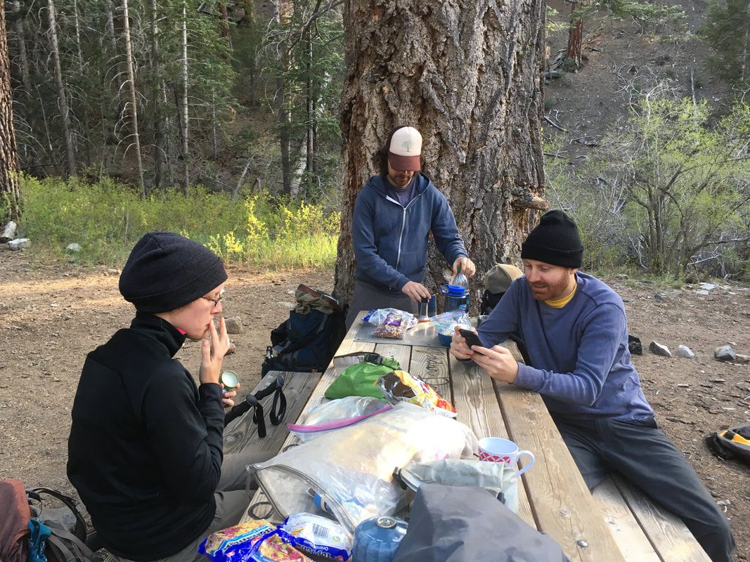 Wow, I never thought I'd have so many readers for this little blog. I'd love to hear from you! Leave a comment below and let me know where you're from and how you found the blog. Thanks for reading!
0 Comments
Friday, May 27, 2016 Lindsey and I reach Fuller Ridge about 9am. We start with a gentle downhill slope, the same slope I had walked when looking for Brian a few weeks earlier. Obviously, Brian and I hadn’t continued hiking the next day. Instead, we drove down and enjoyed a Mother’s Day brunch without our mothers at the local casino. That last 20 miles of downhill would have been a disaster for my knees in the condition they were in—I wasn’t able to sleep through the night because of the stabbing pain every time I shifted in my sleeping bag. I was worried I had done permanent damage, but they were back to normal within a week. So instead, Lindsey will hike this section with me. Brian and Jon, another friend, will pick us up tomorrow at interstate 10 to take us around another fire closure, and the four of us will continue the hike from there. The downhill is easy, and the morning is warm, but this section is shaded by tall pines. In the gaps between trees, we can see tiny windmills far below us, and there is a small cap of snow on the San Bernadino mountains across way. I find this part of the trail to be particularly interesting. For the most part, the PCT follows several mountain ranges. That’s true here, too, but there’s a gap between the San Jacinto mountains, where we stand, and the San Bernadino mountains. This plunge is enormous—almost nine thousand feet from the top of Mt. San Jacinto. The ecology changes by the hour. 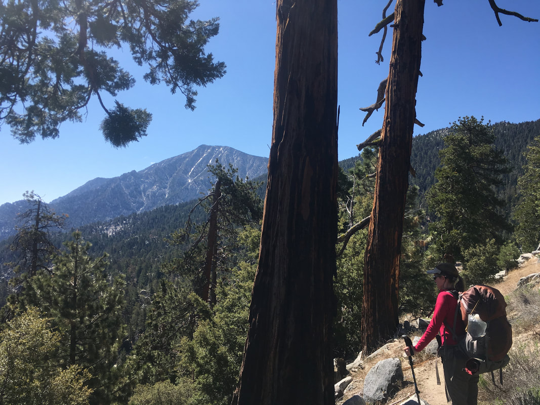   After less than an hour of hiking, the woods disappear and the warmth jumps dramatically. The trail follows a short ridge, then begins a series of switchbacks. For hours, it seems like we are pacing the same section of trail. Switchback one: view of the desert valley, tiny windmills, the long runway of interstate ten extending into the bright hazy distance. Switchback two: the domineering face of Mt. San Jacinto. Switchback one, switchback two, switchback one, switchback two… 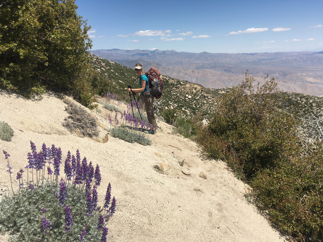 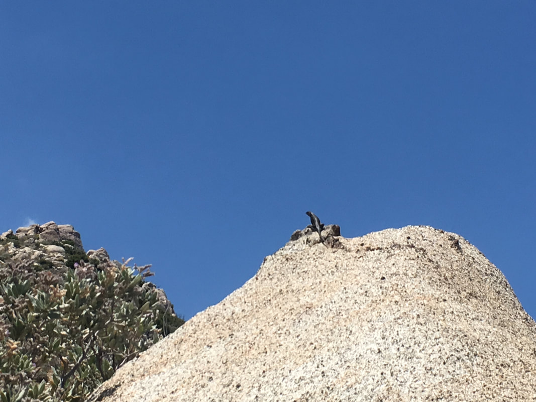 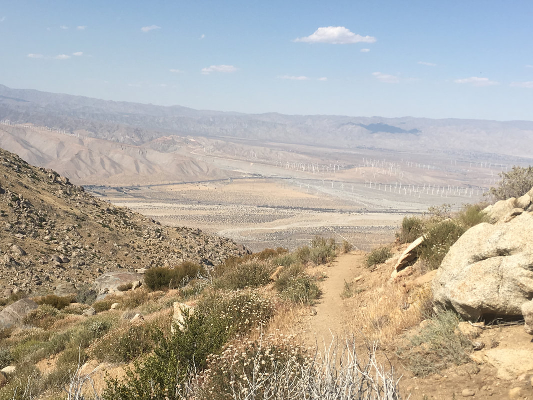 Around 1:30 the heat and a lack of sleep get to us, and we decide to stop and take a nap. There is no shade here, so we set up my rainfly without the tent to serve as a sunblock. It blocks the worst of the sun’s rays, but with little movement in the air, our body heat quickly warms the space. My thermarest is slippery with my sweat within seconds, and sleep seems out of the question. Nonetheless, we are able to take short catnaps on and off for about an hour before my heart starts to race and I am gasping for air. I climb out from under the rainfly and the temperature seems to have dropped a little. There is even a small breeze. I drink some water, which calms my heart, and wait for Lindsey to emerge. We continue our downhill, pass two male hikers, the first of the day, and reach the 200-mile marker. A half mile later, we find another 200-mile marker. I wonder which is correct. 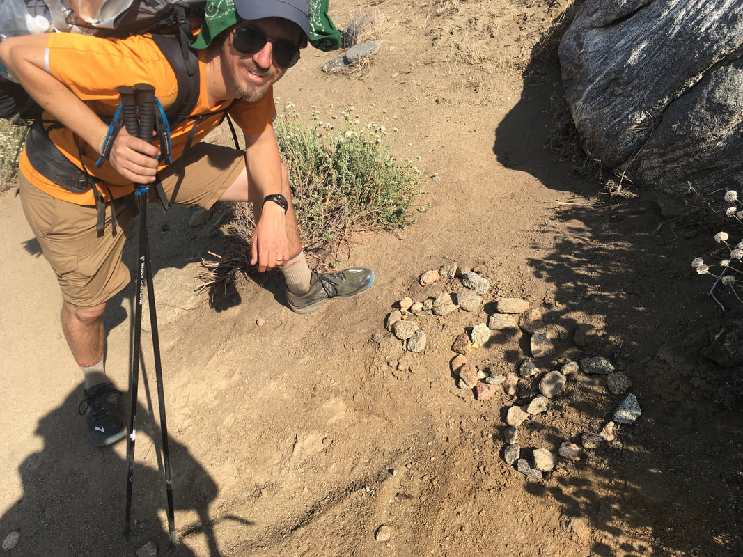 The view on switchback one seems to be getting a little larger, while switchback two recedes ever so slightly. I guess we are making progress. The wind picks up gradually until it reaches a consistent stiffness. No major gusts, but fairly strong and constant. The slope starts to open up, and soon there are actual flat areas near the trail. Lindsey and I start to look for a campsite, and find one behind a boulder large enough to protect our tent from the wind. We eat dinner early, then wander around and explore the nearby boulder formations and look out over a nearby dropoff. It’s a relaxing, enjoyable evening, and we even have a couple hours to read our books before dark. 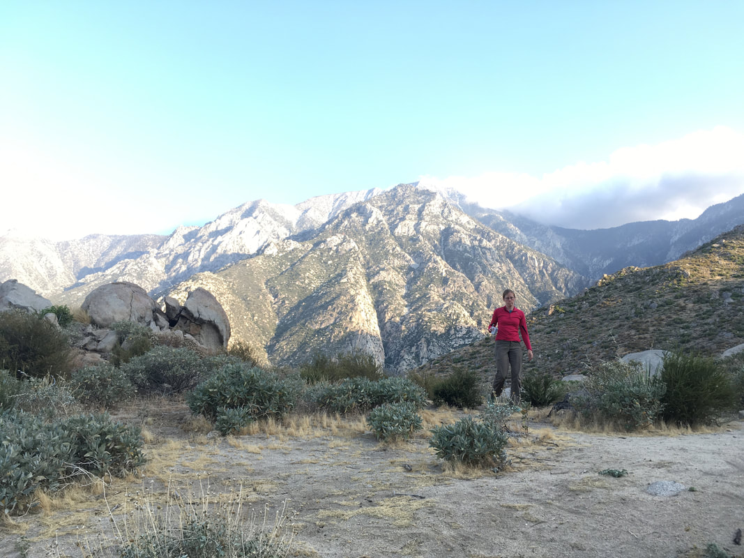 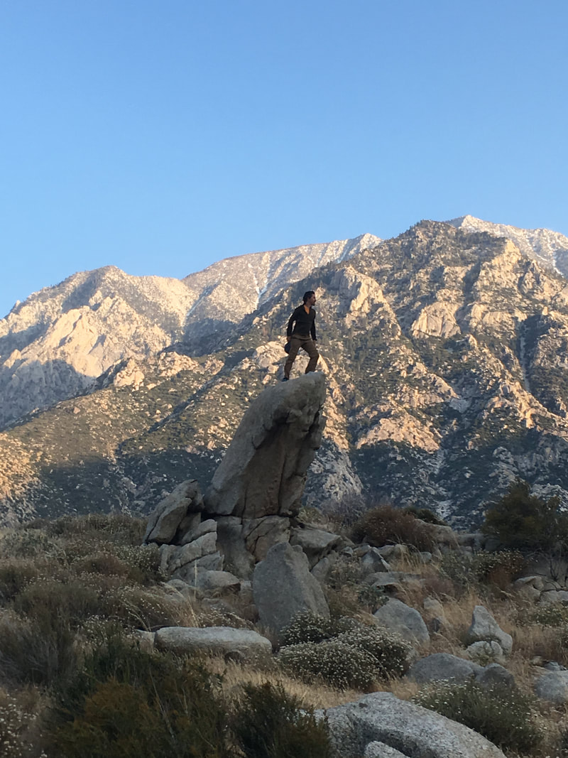 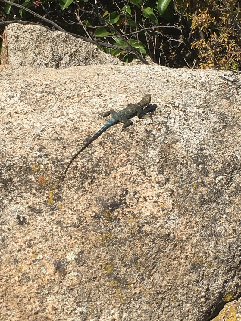 Saturday, May 7, 2016 All the other backpackers are still sleeping in their tents when I depart at 6am. Overcast skies. A cool earthy smell from recent rain gives the morning a laid-back feeling. It’s a good morning for walking quietly alone. My knees hurt, so I am slow and careful as I walk downhill across the campground. Every time I forget and switch to autopilot, a painful twinge reminds me to step more carefully. The Halfmile alternate leaves the campground through the back, tracing a small gulley heading North. After three-quarters of a mile I reach a junction: straight or left. I’ve somehow forgotten the maps for this section, so I check the Guthooks PCT app on my phone to see which direction to go. It doesn’t load properly. Neither does the Halfmile app. I take my best guess and go straight ahead. The trail follows the gulley, cuts across it, and a mile later I'm at a vertical fiberglass marker that says “illegal trail”. Crap, I must have taken a wrong turn. I look closer, and it also says “Motor Vehicles Prohibited”. Maybe they mean it’s illegal for off-road vehicles. I decide to take a chance and check it out; I don’t really want to hike another mile back. The trail turns again, and I come across a small memorial built of rocks, pine cones, and flowers. A small bit of motorcycle helmet, too. I wonder if this was a dirt biking accident, and the next bit of hiking is spent thinking about mortality. I tend to think about it a lot anyway. 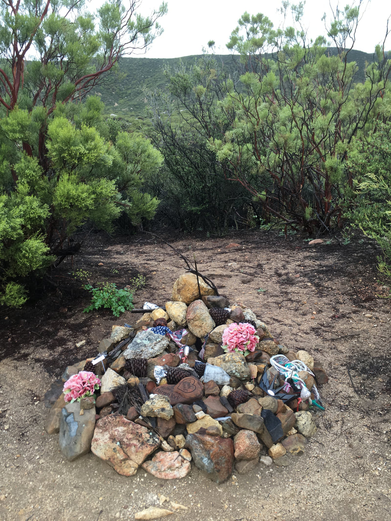 It’s so easy to just disappear off the earth. An accident of health or something physical like this dirt bike accident, war, murder, drowning. There are so many ways to go, and no real rhyme or reason to it. It seems like most people avoid thinking about it most of the time, or find ways to explain it away. The religions give us afterlife or reincarnation, but to me, these are beside the point. Even if those ideas are true, it doesn’t excuse us from the need to do something with this life. After all, what’s the point of a second life if you didn’t do anything with the first? And often, people who orient themselves around the next world are selfishly irresponsible about this one. They impose their beliefs on others, trash the world, and make excuses for not taking action during times of moral crisis by calling it “all part of God’s plan.” Well, what if God’s plan is that we take some moral responsibility and actually do something about the horrible things that are happening in the world instead of assuming everything is going to work out in the end? These are the thoughts that are running through my head as, step by painful step, I work my way further into what is starting to look more like a burn area. I’m just about to turn around, when I reach another junction. I take out my phone, and sure enough, I am nowhere near where I should be. Luckily, someone has written PCT in the dirt, with an arrow pointing to the small trail on my left. 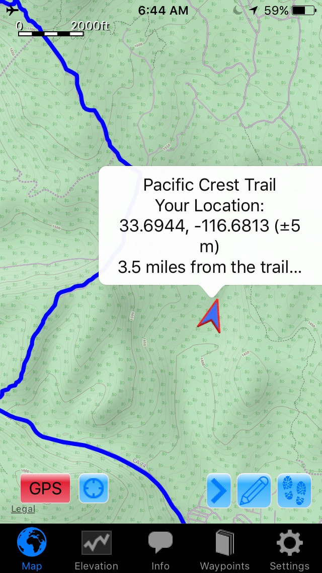 The trail is eroded, but it clearly heads in the direction where I now know the trail to be. I head out through wild, unkempt lands, surrounded by charred tree trunks and millions of wildflowers. Hundreds of birds flit between shrubs and leafless branches. Despite the fire damage, it is disarmingly beautiful. It banishes any trace of negativity and I lose myself to the birds. This is magic. 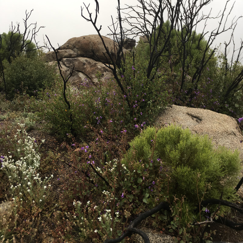 I emerge onto a dirt road. Signs on either side of the road tell me to stick to the road and keep out of this burn area. I feel badly, despite the sublime experience I’ve just had. The Guthooks app tells me that I am back on the alternate trail. 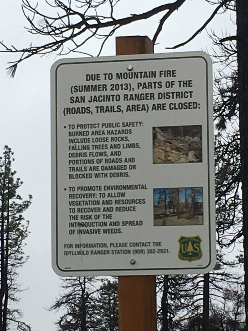  The road climbs uphill for a long while. This is harder on my sore muscles, but much easier on my knees. Eventually, I reach a network of paved roads passing through a cabin community, and I am spilled out onto a highway, which will take me the rest of the way to town. A pickup truck stops. The driver is a guy in his late twenties wearing acid-washed jeans and a t-shirt with the sleeves cut away. He asks if I want a ride, and this time I don’t refuse. My knees hurt, and I didn’t come out here to walk on paved roads. It’s farther to town than I imagined. We talk about Northern Arizona University, where we both went to school, because I noticed a sticker on his back window. He tells me about his experience with Idyllwild, that he moved away because of all the drama, but he missed home and now he’s back and things are better. He doesn’t tell me what the drama was, but the way he talks about it, it seems to hint at a broken relationship. He drops me off at Jan’s Red Kettle, a restaurant that Yogi’s guidebook tells me is a favorite among hikers. I thank him and offer him a little money for the ride. He refuses. I leave my pack outside with several others, a little nervous to leave so much equipment sitting unsupervised. Inside, I order two breakfasts even though it’s almost lunchtime, and I finish them both. I read my book and check Facebook on my phone. I’ve really only been away for a day, but it feels like it’s already been weeks. The PCT is working some strange magic—it feels as if there was no break between the sections of my hike, and the hiker hunger, loneliness, and physical toll have all come at once. I am tempted to stick around town for a while, but I know I had to get moving. Miles to go before I sleep, and all that. I follow the Guthooks app through side streets and up a steep empty trail until I find the parking area for the Devil’s slide trail. Suddenly, people are everywhere. I climb in short spurts, stepping off to the side for thick swarms of people, and I’m glad to catch my breath. I am now firmly out of the desert, and deep into a pine forest. A dusting of snow lines the trail. Then it thickens and covers the ground. I climb for hours, more and more tired as I go. My knees are doing better since brunch, but it might just be the endorphins. 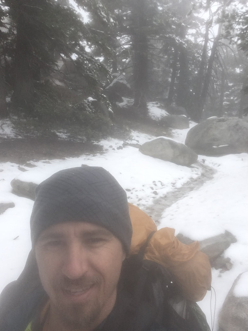 The turnoff for the Mt. San Jacinto arrives, and I take it. The forest drops away, and thick thorny bushes replace it. The bushes create a narrow corridor that can only fit one person at a time, so we all have to take turns moving from one open spot to the next, and my progress is slow. The trail gets steeper, and soon I am stopping after every few steps. I just don’t have the energy. But I keep on until finally, about 4pm, I make it to the top, 10,834 ft. Unfortunately, the weather has conspired against me, and the only view I have is the inside of a cloud. I take a short selfie video, and that’s all the time I have to rest. Brian is probably already waiting for me at Fuller Ridge, and I still have a long way to go. 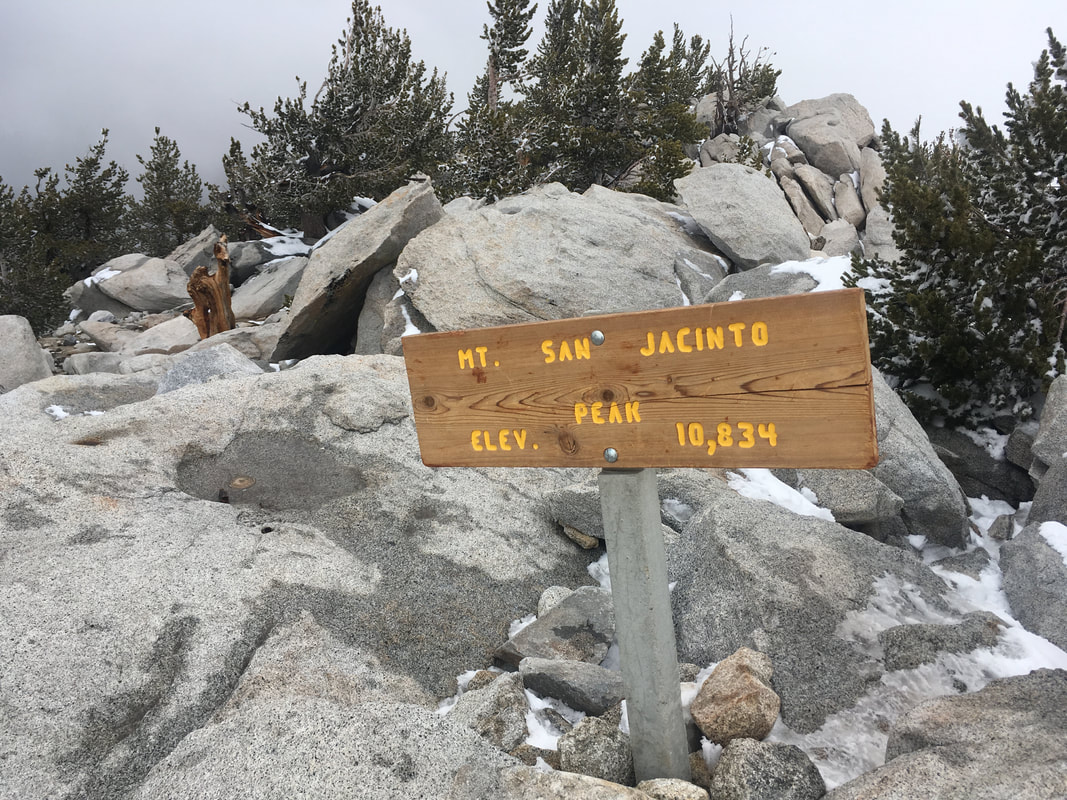 On my way down, I find myself packed in between a large group of hispanic hikers, about 30 in all. The one in front of me doesn’t realize I’m there, and starts speaking to me in Spanish, thinking I’m his friend, who is behind me. When neither of us answer, he turns around and is surprised to see my face. I pass them when they break together in a flat, snowy area. This side of the mountain has a lot more snow. Much of it is in small, icy hills that lay across the trail, and I find myself slipping often on the downhill side. This is hard on my knees. One time in particular, near the end of the day, my right knee buckles under me, I cry out in pain, and I am limping for the next couple miles. My hips, too, feel like they’ve been taken to the limit.   I finally reach Fuller Ridge just before dark. Several tents are around, but Brian is nowhere to be seen. I hike a little farther, to a road. There is no cell service here. I sit down on a log to rest and decide what to do, and Brian’s Jeep comes around a curve less than a minute later. We drive back up to Fuller Ridge, set up camp in the dark, and make ramen for dinner. When I wander off into the dark to pee, I am hobbling. I don’t know how in the hell I’m going to hike tomorrow. 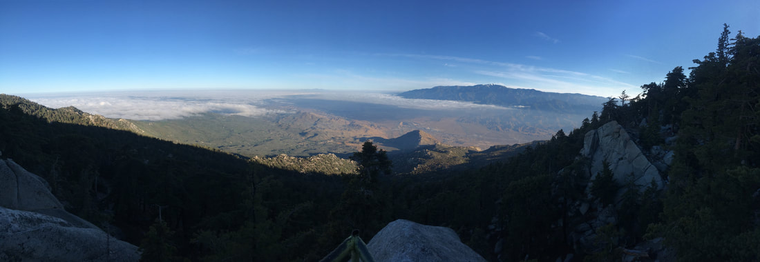 Friday, May 6, 2016 It has been just over a month since day 10. I am camped in a dirt parking lot just off the Palms to Pines highway, across the street from where Lindsey picked me up to go to the Paradise Valley Cafe. It is about 1:30am, and it is good to be back. My friend Brian dropped me off a few minutes ago. We had to do some funky car swapping, because he plans to join me tomorrow evening and hike with me on Sunday. My car is parked where the trail crosses Interstate 10. He picked me up there, dropped me off here a couple hours later, and drove back home to go to work. He was delayed a couple hours from our planned meeting time because there was a police standoff on the freeway that he would have used, and traffic being what it is, most of Southern California shut down as a result. He’ll drive up and meet me at Fuller Ridge tomorrow evening (Saturday), and then we’ll hike down to my car, drive back up to his car, and each go our merry way back to our homes. It’s a complicated plan, but it’s also ambitious. Fuller Ridge is 20 miles away from my car, about 35 miles from here, and I also plan to summit San Jacinto on an alternate trail that adds about 5 miles. So, twenty miles a day. Luckily, I’ve been training. Oops, never mind, no I haven’t. Right now, though, I’m lying in my tent in a dirt parking lot, startling awake at every sound as if it’s the first time I’ve ever been camping. It’s mildly windy, and I’m close to a highway, so there are a lot of sounds to wake me. At 6:45, I wake up to the light and try to decide whether to get up or get some more sleep. This decision takes me thirty minutes. I am dead tired, but I finally decide to get up. I break camp and hit the trail by 7:45. The desert that I remember from a month ago is already changing to a more mountainous type of desert in less than a mile. Boulders and yucca are interspersed with larger bushes and occasional oak. It is strange to have a trip connected mile to mile and so disconnected by taking a month-long break, and I worry that I may have already lost a bit of the experience of thru-hiking by breaking it up like this. 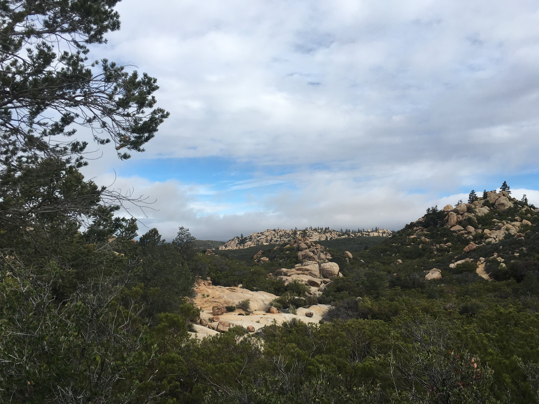 After about an hour of hiking, I come across a couple hikers standing near a tent. A young lady and an older man. The tent is open, and has another young lady sitting inside it, sort of packing up, but not accomplishing much. The man greets me and then continues to hold us all captive for twenty minutes, telling us all what we should be expecting in the next section. At first I think he must have done this section before, but it turns out he’s just a classic know-it-all. I decide I’ve had enough, and tell him I have to get moving. I stop a while later on a large flat rock overlooking the trail and make breakfast. Oatmeal. The trail comes up a shallow wash here, and the young lady from earlier hikes along it and then disappears. When she reappears and reaches me, I joke that she got lost along the way, and she looks at me funny. At first, I think that she doesn’t speak english very well—she has an accent that I can’t place. Then I realize that she probably left the trail to go to the bathroom. Poor joke. We make small talk about our packs—a larger version of the Z-Pack arcblast, and wants to know if mine is getting worn through on the bottom like hers is. It isn’t. I learn that her trail name is Sugar Rush, because she raced to Julian for the pie. The other girl in the tent has been her camping buddy for the past few days, but they usually don’t hike together, they just meet up in the evening and set up camp near each other. She continues on, and I finish my breakfast. The trail continues to wind among the boulders and scrub brush. Occasionally a fire road passes by or crosses the trail. Big puffy clouds cross the sky, but it is mostly sunny, if a bit windy. I pass Sugar Rush again and we hopscotch for about an hour before I leave her behind on a steep uphill. The trail climbs the ridge for a while, and I remember that a previous thru-hiker told me there was a great place to camp up here, where you can see the lights of palm springs in the distance. But it’s only 10am. Maybe I can come back here some day. 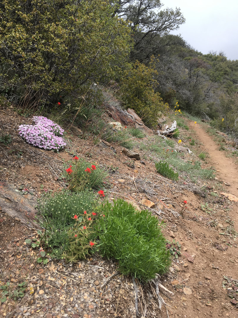 I’m glad I decided to hike this section. Because of a fire closure coming up, I’ll have to do a long walk-around called the Halfmile alternate. Halfmile is the trail name of the guy who created the alternate, not the distance of the alternate. It’s more like twenty miles. All this uphill gain that I’ve accomplished today will be lost in a long series of descending switchbacks, followed by a road walk, and another long uphill climb. Many thru-hikers decide to skip it for this reason, but it’s pretty here, and I’m glad I didn’t miss it. 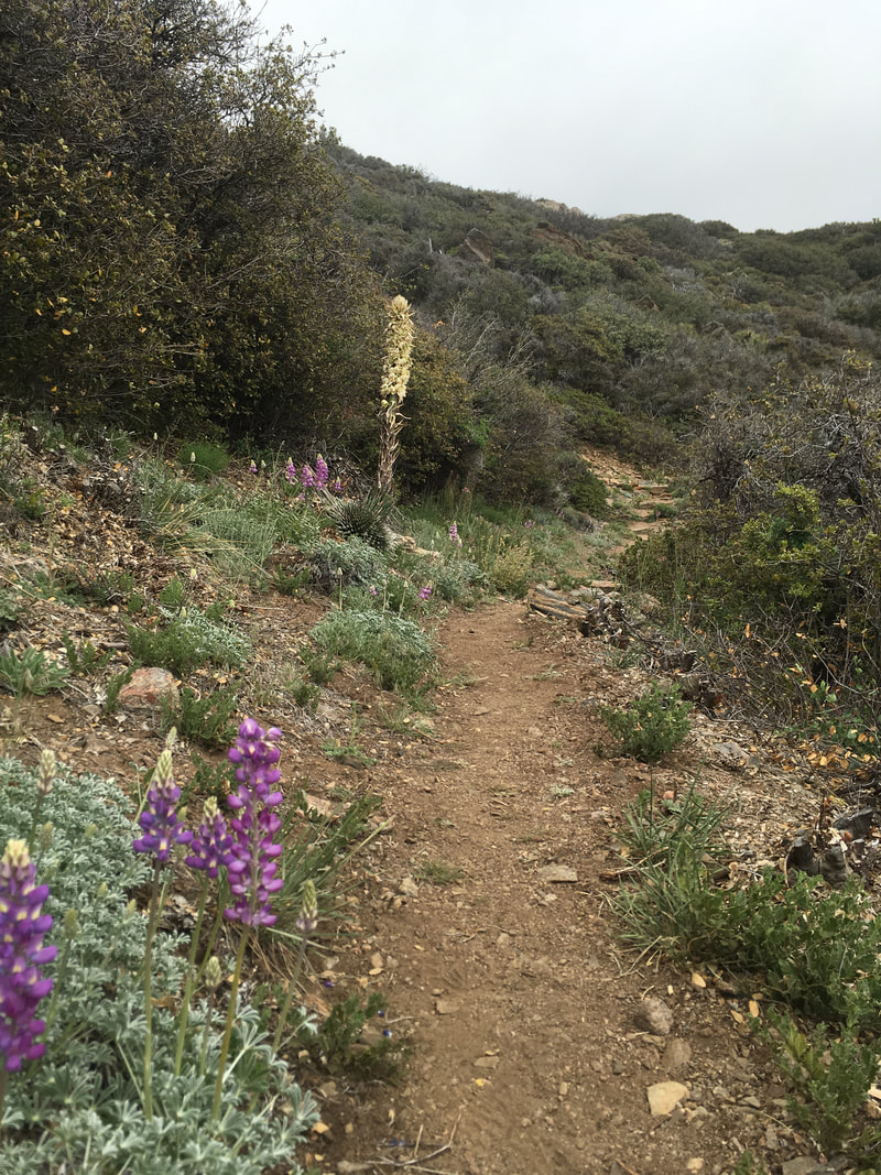 As the ridge line climbs higher, the wind picks up, and then it starts to rain, snow and sleet, all at once. It looks like it’ll be short-lived, so I don’t bother to get out my rain gear, but the weather lasts just long enough to soak my clothes and make me clammy. The clouds stay put, and the grass and small plants that line the trail keep continue to paint my legs wet. I reach the Cedar Spring turnoff—where I’ll leave the official PCT and start the long downhill—and I hear voices ahead. They are coming from the closed section of trail. I wonder if these are hikers who ignored the closure. I decide to take a break before I head down the switchbacks to Cedar Spring. A moment later, I have my answer—two men come out of the bushes wearing hard hats. One is emblazoned with a forest service logo, the other with a PCTA sticker. They have been checking the trail for restoration to decide whether it will be safe to reopen it soon. Too late for me, though; I’ll have to hike around. I take the long downhill at a trot. It’s hard on the knees and feet, but easy on the cardiovascular, and the long grass continues to wet my legs and keep me cool all the way down. I take another break at Cedar Spring, refill water and snack on peanut M&Ms. It seems like the sort of place that should have a picnic table: big tree, lots of grass, trickling water. Showers continue intermittently, and I break out the rain gear. 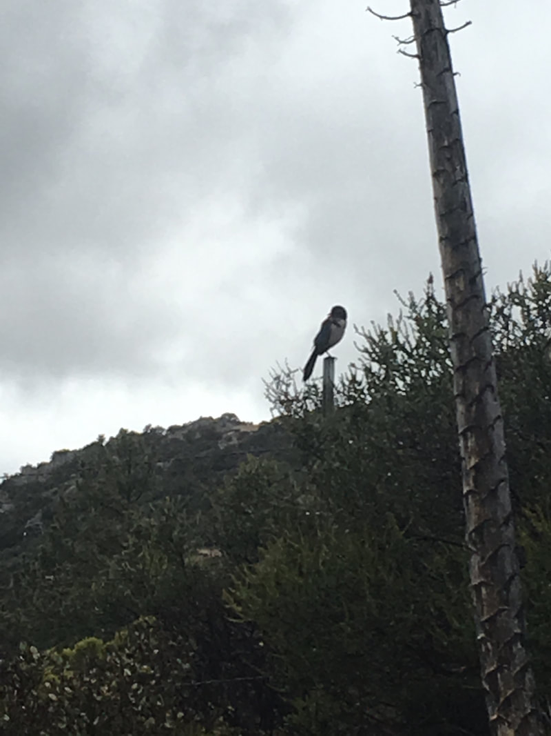 The trail emerges onto a paved road, but I’m not on the PCT anymore, so there are no signs to tell me where to go. I check my maps—it’s the first time I’ve really needed them—and turn left. Around a turn is a forest service truck, and the hard-hatted men are climbing in. I’m tempted to ask for a ride, but I’m not ready to give up just yet, no matter how tired I feel. Speaking of which, I’ve only hiked about 13 miles so far today—why am I so tired? The road meanders gently for a while. In a car, I love this kind of road. It’s the sort that takes you to hidden places, and where you feel like you’re passing through wild unmapped lands. But on foot, each step is like a hammer pounding upwards on my feet. I feel it through my knees and hips, even up through my back. I check my maps religiously, because there should be a turnoff coming soon. I almost miss it, because it looks like a gated road to private property. In fact, there is a sign that says private property, but there’s also a forest service sign and a small gate for foot traffic. I start down a dirt road strewn with fist-sized stones. At first it’s level, but after a mile or two, it starts to descend sharply. The rain continues on and off, and the road is either pavement-hard, ankle-busting rocks, or slick mud beneath my feet. I have views to a large meadow below, speckled with aspen and fir. The palms to pines highway cuts across it, southeast to northwest, and I can see two to three matchbox-sized cars passing through at any time. As I slide down muddy road, pound my knees into tractor-compacted dirt, and slip on stones, by knees and feet begin to really hurt. I take a few more breaks, but they don’t do much except give me a reprieve. The downhill seems endless, but I do finally make it to the basin, and the ankle-turning rocks disappear. Up ahead I see Sugar Rush. I wonder how she got ahead of me! I don’t find out until we reach the highway, where she is trying to figure out the next step on her map. It turns out that she missed the turnoff to the private road, and her walk ended up being shorter. We cross and start walking down the highway together, chatting in the rain, which is steadier now. A woman in a car stops to ask if we want a ride to the Hemet market, but the rain is sort of pleasant now, and after that long uncomfortable alternate, we’ll be damned if we’re going to start skipping sections now. We thank the woman, but walk the last few miles to the market.
The market has a nice patio with metal tables and chairs, but they are all chained up, so four or five hikers sit under the eaves against the wall. I go inside and get a large bottle of beer and a candy bar and go back outside to shiver with the other hikers. Sugar Rush’s friend shows up a moment later: she hitched the last few miles of road. We all talk for a while, and they decide to try to hitch up to Idyllwild instead of hike the rest of the fire closure. Less than a minute after that decision, a man comes out of the store and asks if any of us want a ride up to Idyllwild. They take the ride, and I opt out. I know it’s a really common section to skip, and it’s not officially the PCT anyway, but I don’t feel right about skipping it. After they leave, I finish my beer, use the restrooms, and hobble down the road. The rest has given my joints and muscles time to stiffen, and the pavement is painful. It’s a rainy half mile to the campground, and the other hikers are already napping in their tents when I arrive. I make dinner and turn in early. It’s only 6pm, but I have hiked 21 miles. I’m tired, I hurt, I'm cold, I'm soaked through, and I’m also strangely satisfied. April 2, 2016 A couple times through the night I become conscious of coyotes howling. Earlier, they were off a ways to the northwest. Now, closer and to the east. I wonder how close they had passed by my tent, but I am not worried. Bears and mountain lions worry me; coyotes seem harmless. I look at unknown constellations through the mesh ceiling on my tent and drift peacefully back into my gentle dreams. In the morning, I am well rested; so far, this is my best night of sleep on this trip. The predawn light gives the morning a fresh happy feeling, like a blank canvas or a new book. I climb out of my tent, and ooh! Ouch, my feet are tender! The previous day’s 25 miles have taken their toll. This is the first time my tent has been dry in the morning. It’s more enjoyable and faster to pack up with dry hands, and I break camp within 15 minutes. These desert hills are hard on my sore feet, but I’m able to ignore the pain after a while. I focus on the stillness and emptiness of the desert. No sounds except the sandpaper crunch of my shoes, no motion but mine. 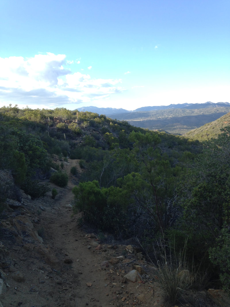 Between dinner, breakfast, and a few sips in the night, I have nearly run out of water. The water report says the next reliable source is Tulley Spring, about a half mile off trail. I’ve been avoiding hiking off-trail to get water, but it looks like this time I’ll have no choice. The next few water sources are caches left by trail angels, and I’ve heard that some hikers have arrived to find the bottles empty and no one around. The angels are having a difficult time keeping the caches stocked for the larger number of thru hikers that have begun to use the trail this year. When I arrive at the dirt road that turns off toward the spring, I see a mesh tent. A man sits up in his sleeping bag and looks out at me. I feel like I have somehow violated his privacy, but he is set up right next to the junction, and I don’t see how I could have avoided it. The road heads downhill, and I see a few more tents scattered around. A woman calls out hello to me as I reach the spring, which is really a hose attached to a pump. I sit down and start filtering water with my Sawyer Squeeze. It takes me about ten minutes to filter 4 liters, and during that entire time, the woman who called out to me has been brushing her long blonde hair. She is still brushing it as I start to climb back up the hill. When I get close to the trail, the man who looked out from his tent earlier is hiking down. We exchange a few words, and I joke that the climb back up is much harder than the way down. He replies that that was why he left all his stuff at the top. Oh yeah, I guess I could have done that. Most of my backpacking experience is from the Sierras, where an unattended pack is prey to bears, marmots, and chipmunks, so it didn’t occur to me that I could just leave it and come back. Oh well, too late now. 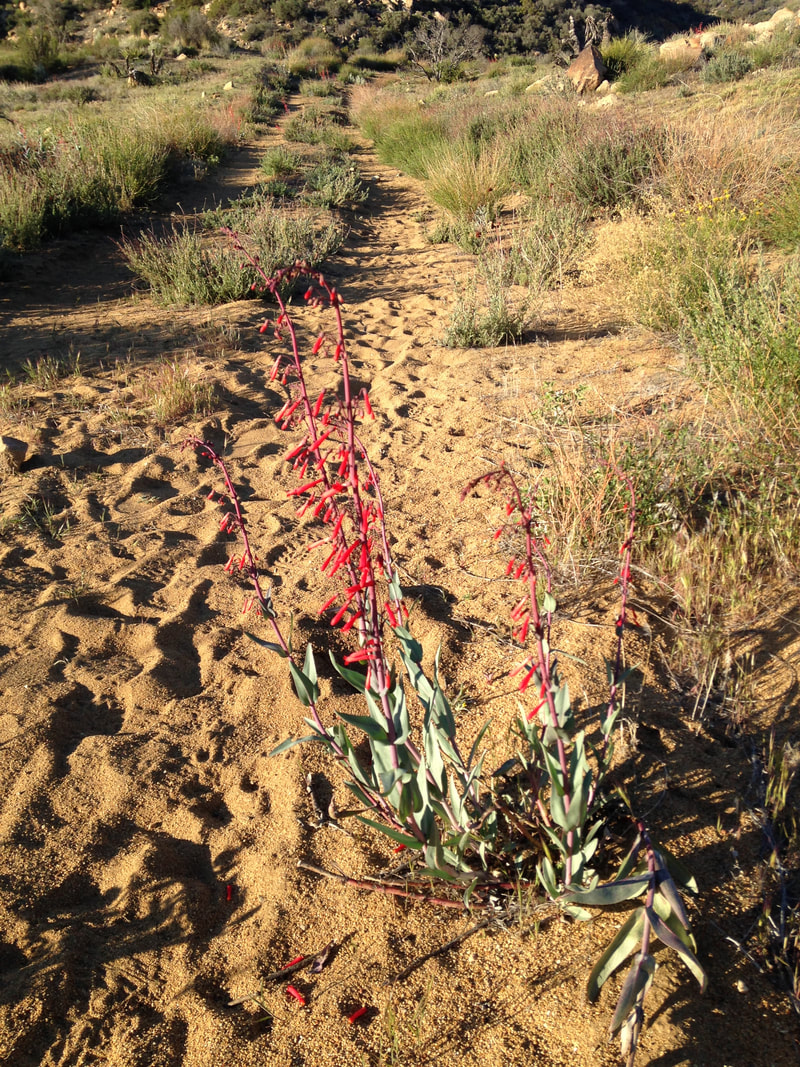 I hike down and back up through a couple canyons, then up a sandy slope near a semi-developed area. The lots are spacious and rectangular, each with a single mobile home or RV in the center. Plastic chairs and children’s toys are scattered in the dirt. There is no one around, and I can’t decide if the area is abandoned or if it’s still too early in the day for normal people to be awake. Speaking of normal people, what sort of people decide to live out here, far from people, in a harsh desert landscape? The desert can be beautiful, but these ugly lots are not. Nonetheless, I begin to feel like I can understand the desire for a simpler, more relaxing life, and how that might outweigh the need for greenery or society. 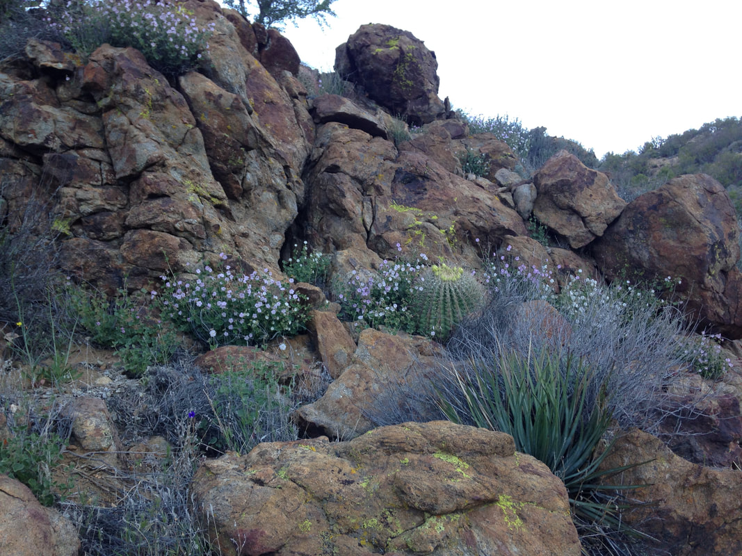 I come across the first water cache, a set of shelves with one gallon plastic jugs. But I am still full with water, so I sign the trail log and move on. A little while later, I come across the second water cache: Malibu East. It sports a variety of island kitsch, including surfboards and painted bar signs. I skip this one, too. Later, I will learn that a cooler is often stocked with cold soda, and the pit stop features a tiny library, and I will regret my haste. 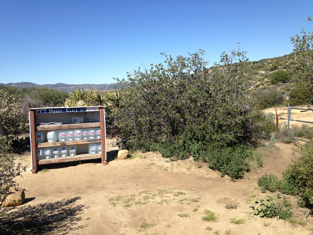 I start another long climb, with each rise giving way to a higher rise, and cactus flowers on all sides. Canyons drop to the sides of the trail in steep, dizzying cliffs. I am on top of the world. As I approach the final crest, the flora suddenly changes from sparse cactus to grass and shrubs. A horned lizard scurries off the trail and hides in the grass. A sign reads “table-top road”. 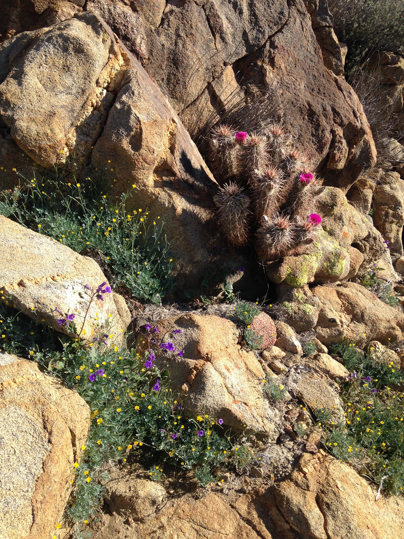 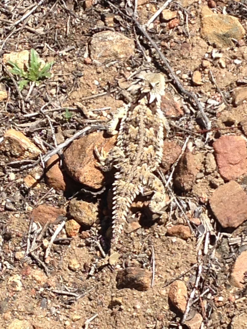 A new valley opens before me. To the left, a verdant slope is topped with a tractor and a mobile home. To the right, the valley crumbles over a precipice into distant views of rocky desert. Straight ahead, a large mountain obscures the San Jacinto range behind it. A single scar cuts across the mountain face—a graded dirt road—and a distant hiker appears there as a white dot, slowly and steadily climbing. 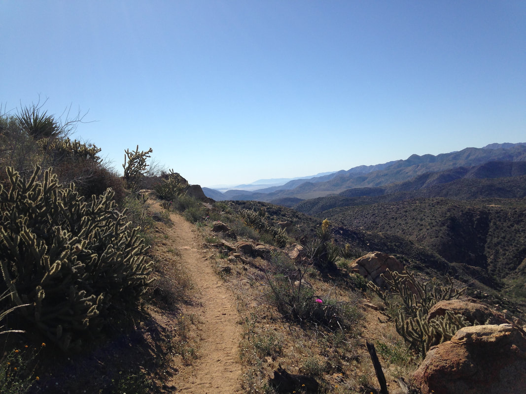 An overhanging bush provides shade for a rest and a snack, both of which I need sorely. The temperature must be pushing triple digits, and my feet are still tender. I check the map, do some mental calculations on my pace, and text Lindsey to tell her I should reach the road at about two o’clock.
When I start hiking again, the trail follows the disintegrating edge of the valley, mere inches from the steep erosions that spill into the desert. It is exposed and hot and dry, and I can’t seem to drink enough water to keep my throat wet for more than a few seconds. When the trail turns onto the the dirt road I saw earlier, I am too tired to climb but too hot to stop in the sun, so I push through and slog slowly uphill. The promise of a good meal at the Paradise Cafe keeps me going. The road turns, and I am rewarded by a short downhill section before I reach the road. It is 1:58. I walk out the gate and turn left, toward the cafe. It is another mile of road-walking, but I only take a few steps before I see Lindsey driving up to meet me. At the Paradise Valley Cafe, we sit outside on the porch with bikers and road warriors, and I am simultaneously proud to be a PCT hiker and embarrassed of how I smell and look. The bustle of the restaurant seems somehow distant from me, like I am watching it through a pane of glass. It also seems so unnecessary. Lunch is enormous and delicious: Veggie burger, french fries, chocolate shake and a beer. When we get up from the table, I’m not sure what makes it harder to move—sore muscles and tender feet, or my bloated belly. We drive up the road to a small bed and breakfast in Idyllwild. As grateful as I am to have a bed and shower waiting for me, I already miss the trail, and I can't wait to come back. April 1, 2016 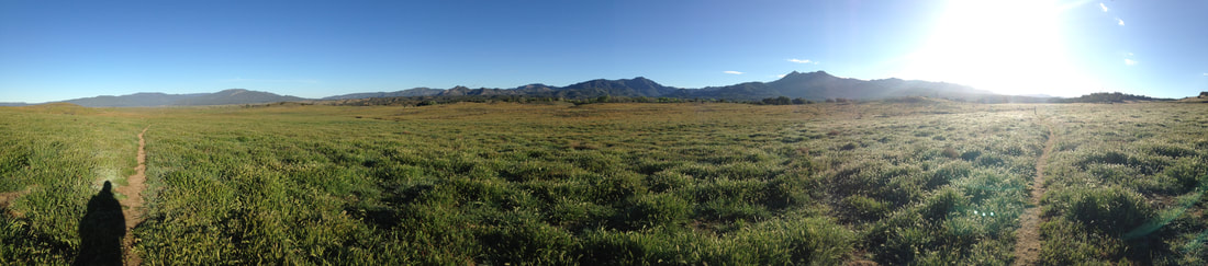 It’s a tenth of a mile to the road. To the right is a fire station, and past that, the Warner Springs school grounds. My mom used to teach at that school. My adopted siblings Wanish and Autumn were students there. Elementary, Middle, and High School are all on this one small campus. Across the street is the community center. The area is a large fenced in square, with showers, restrooms, a small market, a parking lot, and a large lawn, which hikers are invited to camp upon. The market is closed this early, but I have plenty of food anyway. While we wait for my mom in the parking lot, I check the weather for the next two days on my phone. Sunny and warm, no wind, no rain. I decide to lighten my pack. Rain jacket, wind shirt, thermals, extra food—it all goes with Lindsey. My pack would be considerably lighter if it weren’t for the 4 liters of water that I have just refilled. Mom, Wanish, and Autumn show up with homemade egg and cheese bagels and chai lattes from Starbucks. Who says backpacking can’t be luxurious? We sit on the back bumper and devour our food. A couple of backpackers—one male, one female—who were camped on the lawn come over. I can tell they’re hoping this is trail magic—gifts of food and other kindness from random strangers, whom we refer to as trail angels—, and I suddenly feel guilty for not telling my mom to bring some extra food to share. They don’t seem to expect it, though, and they stick around to talk even after it becomes obvious that there’s no extra food. They are hiking with their friends, another couple who have to get off the trail due to knee problems. I’m grateful that my knees have held up. I’m anxious to get going—every fifteen minutes I spend resting is three-quarters of a mile that I could be hiking, and today will be my only chance to do some big miles. I chug the last half of my chai, hug my mom and siblings, kiss Lindsey, and depart on my own just before 7am. The trail is back on pastureland that slopes down to the west, affording a long view. The morning air is cool and pleasant, and the sun is just reaching over mountains to the east and glinting off the dewey grass. Once again, I am filled with a sense of gratitude. 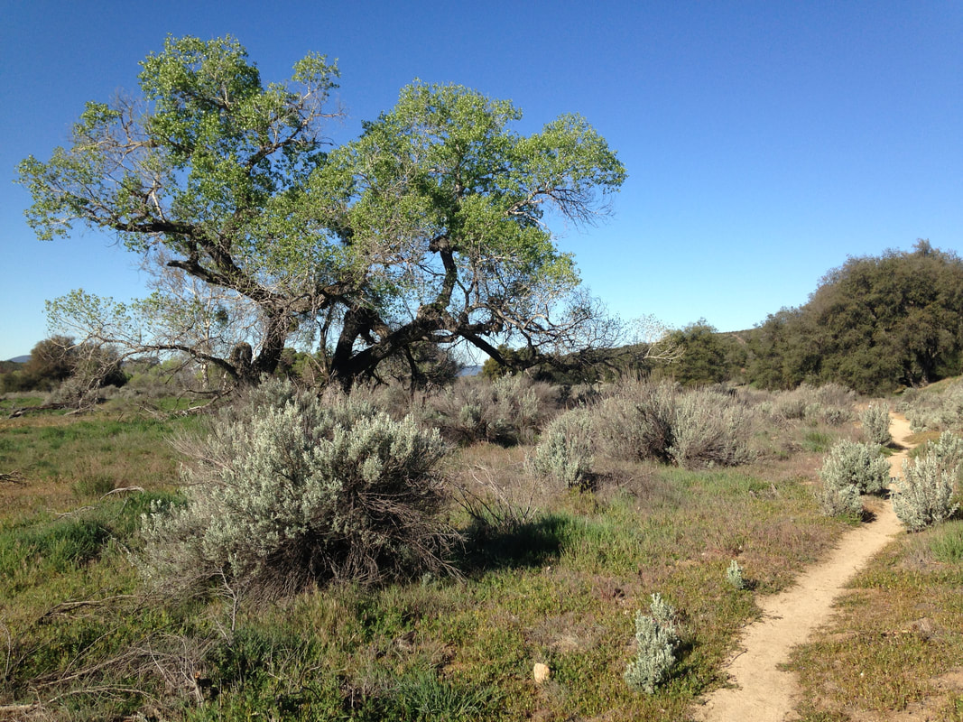 It doesn’t take long before the caffeine from this morning’s chai courses through me. A volume knob has quite suddenly been turned up dramatically: my sense of awareness, thoughts and ideas, the buzz of energy all seem to intensify at once. Physically, it manifests in a quick rhythmic pace and a long, sure stride. I am pure energy unfettered. The trail slopes down between trees, and I almost lose my way among several dirt roads and what seems to be an obstacle course designed for team-building. I cross another road, paved, and walk above a tree-lined wash that is obviously aiming for the mountains ahead. I pass into and out of the shade, and each time the shift in temperature seems more dramatic. Eventually the trees become more sparse, and more time is spent under the heat of the sun. I pass a campsite. An older hiker is just putting out his illegal campfire. This will make me angry for at least two more miles. The whole of Southern California is tinder; snap the branch of any bush or tree to see how dry and brittle the vegetation is here. Fires that destroy entire ecosystems and communities spring up weekly. But fuck all that, my personal desire to look at a pretty fire in the morning is more important than the homes and lives of countless animals and people. Fuck that guy. As the trail reaches the foot of the mountains, I cross paths with the father and daughter we met the previous day. The mother and son are hiking a little ways ahead. They must have passed while I was at the community center. I stop to talk with the father for a couple minutes, and the daughter jumps into the conversation to add anecdotes about her little brother. She is proud of him. Another shift in vegetation as I start the climb up the mountain: trees exit stage left, thick chaparral enters from all directions. It forms walls on either side of the trail. This goes on for miles as I wind my way up the mountains. Over and over I look ahead to what appears to be the high point of this section, only to turn a corner and realize that there is another, larger mountain behind this one. It seems impossible that I am still headed uphill. It seems like there there should be a metaphor for life in this endless succession of peaks, but I can’t decide if it’s positive or negative. The long uphill hike is a blur punctuated only by momentary images: A lone female hiker lies in the shade between bushes, eating one of three snickers bars she has laid out on her mat. At a spur trail to a nearby spring (the water report mentions an accumulation of leaves and larvae—I skip it), a PCT marker provides a sunny spot for a lizard doing push-ups. Passing around the side of a mountain, an overhanging tree trunk sports a kitschy wood sign: “Take a picture, it lasts longer.” Longer than what? Perhaps longer than this wilderness. I’m still pissed at the fuckwad with the fire.  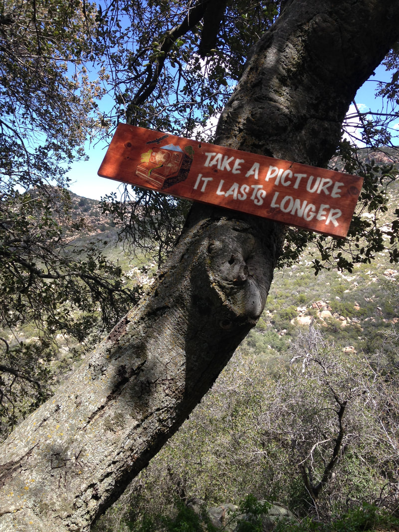 I finally reach the top, and the trail mercifully tips me downhill into a playground of khaki boulders and flowers of salmon and plum. The basin is a three-sided bowl, tipped toward the northeast. This seems as good a place to break for lunch as any. “Keep going Spinner!” is written in the dirt.   After lunch, I am rewarded with a good half hour of downhill, and then the uphill starts again. I am baking. Water quenches for a moment, but a parched throat is the general rule. A plywood sign sits on the ground next to a side trail, announcing “Water and Shade,” and I can’t help but take the offer. It’s a short steep climb to a dirt road, and then I’m left to decide which way to go. I choose downhill, of course, and around the first turn is a water tank. No shade, though. A note from the owner tells me to treat or filter before drinking, and that there is shade at the house below. I can hear a guitar and voices talking. I fill up another four liters, drop some money in the donation slot, and make my way down to the voices. 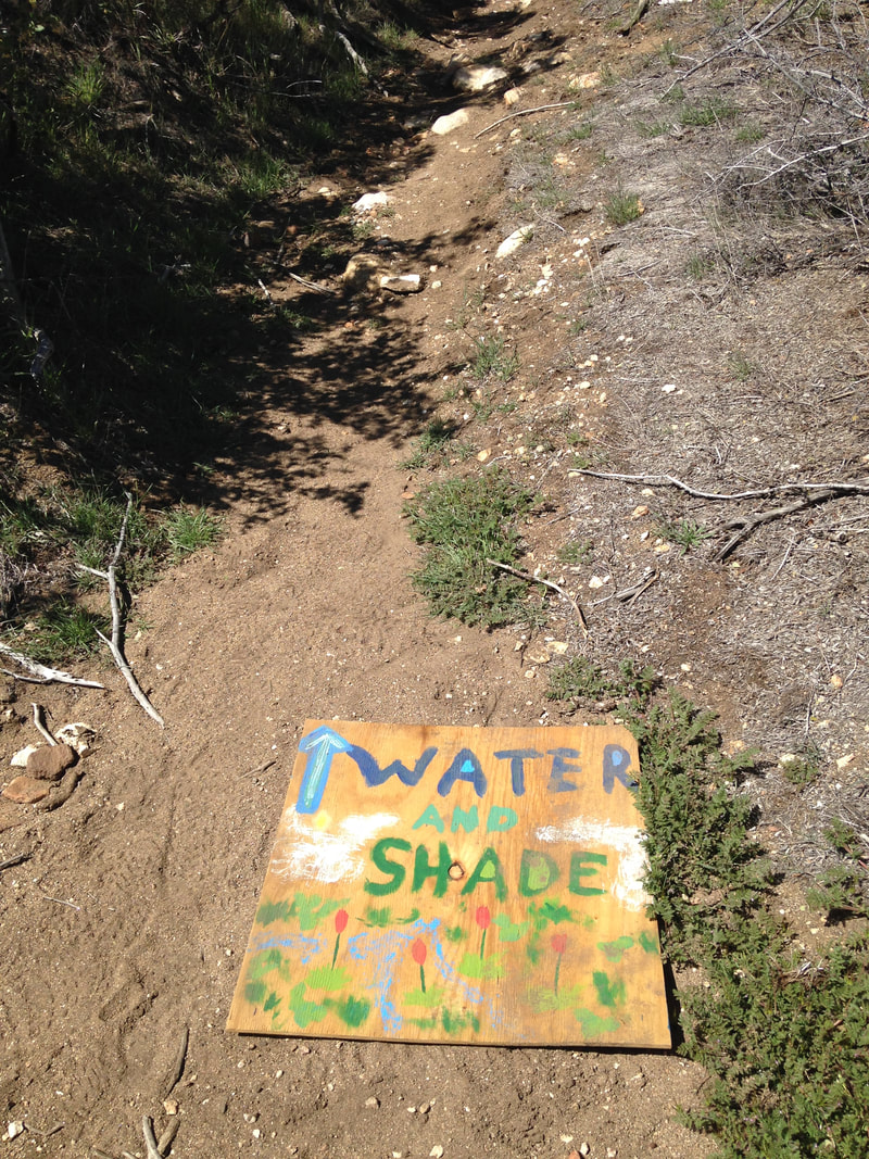 I arrive to find several people sitting in plastic chairs and talking while a guy in dirty jeans and a ratty t-shirt stands next to a clay oven and drinks a Budweiser. Music pours loudly from the nearby house, and a broken down RV sits on a nearby hill. This is Mike’s place. Mike isn’t here, but the man drinking the Bud is the caretaker, and offers me vegetarian pizza. I gladly eat three slices, and rarely has pizza tasted so good. I meet a family of three—the daughter is “Spinner”—and a group of four garrulous older women who introduce themselves as the Facebook Ladies. One of them offers me a Ghiradelli chocolate. We take turns learning each others’ stories—the family is thru-hiking, the Facebook Ladies met through a Facebook group dedicated to section-hiking the PCT. I stay for about forty-five minutes, and then decide that it’s time to get going. Someone asks me if I have a bong hit on my way out. I respond “Sorry, I’m a teacher”, as if that somehow precludes marijuana use. But I don’t have any, and I’m not interested in smoking today. I return to the PCT via Chihuahua road and start another long climb up the side of a solitary mountain. How am I still going up?! After a couple hours of climbing, the trail passes over the shoulder of the mountain and traces a fairly level path around its side. It starts to get sketchy. Parts of it have eroded down the side of the mountain, and the slope is steep. A fall here could be serious, maybe even fatal. I pass without incident, and start a sharp descent. I can see foothills to the north and houses to the northwest. By the time I reach the foothills a couple hours later, I am dog tired. I climb through the bushes to a campsite on a sandy orange hill about a hundred yards off trail. I cook pasta for dinner and read my book in the sunset. I climb into my tent feeling peaceful and spacious. I drift off to the sound of coyotes laughing.  One of the coldest nights on trail so far. Windy, but not violently so. I wake first and let Lindsey sleep. The calm pace of the trail seems to have opened a space in my mind for thinking. I write in my journal about money: Money is a means to an end. It buys security. It buys power. It buys status. It buys adventure. It buys gifts. The trick, then, is to buy what you really want. Don’t pay overmuch for security if what you really want is adventure. Don’t buy status if you crave free time. Don’t buy someone else’s dreams. Live your own. I am thinking of the micro-coercions that we impose on each other daily. The look that says “you’re doing it wrong” every time we see someone make a different choice than we would make. The light teasing when someone does something that’s out of sync with your tribe, like dye their hair an unusual color. Even a loving concern can be used as a micro-coercion if it is based on your own set of goals for the person rather than their own wishes and desires. I am thinking, most especially, of my desire to thru-hike this trail in a single summer. To do that, I need to quit my job. And to do that, I’ll need to put up with micro-coercions from friends and family. Death by a thousand micro-coercion cuts. The biggest one of all, the one I don’t have a good answer for, the one that if I’m honest scares me too, is “What are you going to do for money after you get back?” Because the truth is, I have no idea. It’s safer to just keep my job and section hike in the summers, even if I’ve grown to hate my job. I don’t have the courage to face the micro-coercions yet, so instead I’ll just fall into line, plod through a monotone existence, and push my dreams into an endless future that never arrives. Kill me now. This line of thinking might seem morose, but really I’m girding my loins for battle, encouraging myself to take the step that I know that I want to take, which is to quit my job and complete the rest of the hike in one go. But that’s a battle for another day, and it’ll take more than a journal entry to build up the courage to face all those micro-coercions. For the time being, I’ll just enjoy being out here.  When Lindsey wakes, we break camp and hike a ways before breakfast. Within a half hour, we cross over the top of the mountains and start a long, slow descent. We pass Billy Goat’s cave, which is a tiny bivy-sized hole cut into the side of the rock. I wonder whether it is named for the trail celebrity Billy Goat, or if the name goes back further.  The ecosystem changes drastically, from burnt out desert to lush chaparral. I marvel at how quickly the vegetation changes between one side of a mountain and the other. We look for a good place to eat breakfast, but the chaparral is tight along the trail, so no place is forthcoming. Eventually we find a small ledge right on the edge of the trail. We haven’t seen many hikers since two days ago, so we shouldn’t be in the way. Our feet hang over the edge of a small valley, dangling near prickly-pear cactus, and we cook oatmeal and drink hot chocolate-flavored instant breakfast. Northbound hikers suddenly seem to come through on an assembly line. Every few minutes is another group of two or three. We expect that some of them would be hikers we’ve met over the past few days, but they are all fresh faces. One of them whistles cheerfully as he comes around the bend—a pure, joyous tone. It’s the sort of morning for whistling. When we start back down the hill, Lindsey’s knee starts to bother her. I give her my hiking poles to help her brace on the downhills. Our pace slows considerably, but we aren’t in a rush, so it’s fine. We reach the 100-mile mark, which is just some stones next to the trail. Mile-stones. This pun will delight me for hours. We high-five and take some pictures.  By the time we make it to Barrel Springs and refill water, I can tell that Lindsey hurts. We rest for a while in the shady grove. When we finally get back up, she is almost hobbling. The trail crosses a road and follows a jeep trail down a sandy wash before entering another ecosystem—desert again, but greener desert—and we hike along a small canyon. Lindsey’s knee stabs at her again, worse this time. We break, only a half mile from our last break, and she tells me that she’ll have to stop after we get to Warner Springs. I’m sad for her, but I’m also a little relieved; I had planned to do more miles each day. We discuss options for getting back, and it quickly becomes apparent that we have different expectations: she wants me to stop, too. I have three more days of spring break, and I’m not ready to stop, and we get into a small argument about it. She wants to finish the rest of our vacation together, and while I want that too, I’m also worried about the heat later this summer. I only have a couple weekends to break off chunks of the trail before I can start it in earnest in June, and I need to finish as much of the desert as possible before then, or else I’ll be in the Mojave in July. As we argue about options, I realize that this might be about something bigger. I’m going to be away for a couple months this summer. Maybe she’s worried that I care more about the trail than about her? That part of my reason for wanting to go away hiking for months at a time is to get away from her? I try to allay her fears by talking about them directly. She says she’s not worried about that, but somehow it diffuses the tension and we both get more creative about options. We decide that she’ll get a ride from my mom tomorrow morning and drive up to Idyllwild for the night, and I’ll hike two more days with bigger miles, and then stay in Idyllwild with her on the last night. She’s excited to explore the little mountain town, so it’s a compromise that makes both of us happy. I call my mom and arrange a ride for Lindsey tomorrow morning in Warner Springs. The new desert section doesn’t last long, and soon we are in long deep furrows of meadowy pasture. We pass a sign that tells us we are on Indian reservation land—this is the reservation where my adopted brother and sister were raised!  We get to eagle rock in the afternoon and stop to climb around, take pictures, and eat lunch. The rock formation looks so much like an American eagle that it’s hard to believe it’s natural. 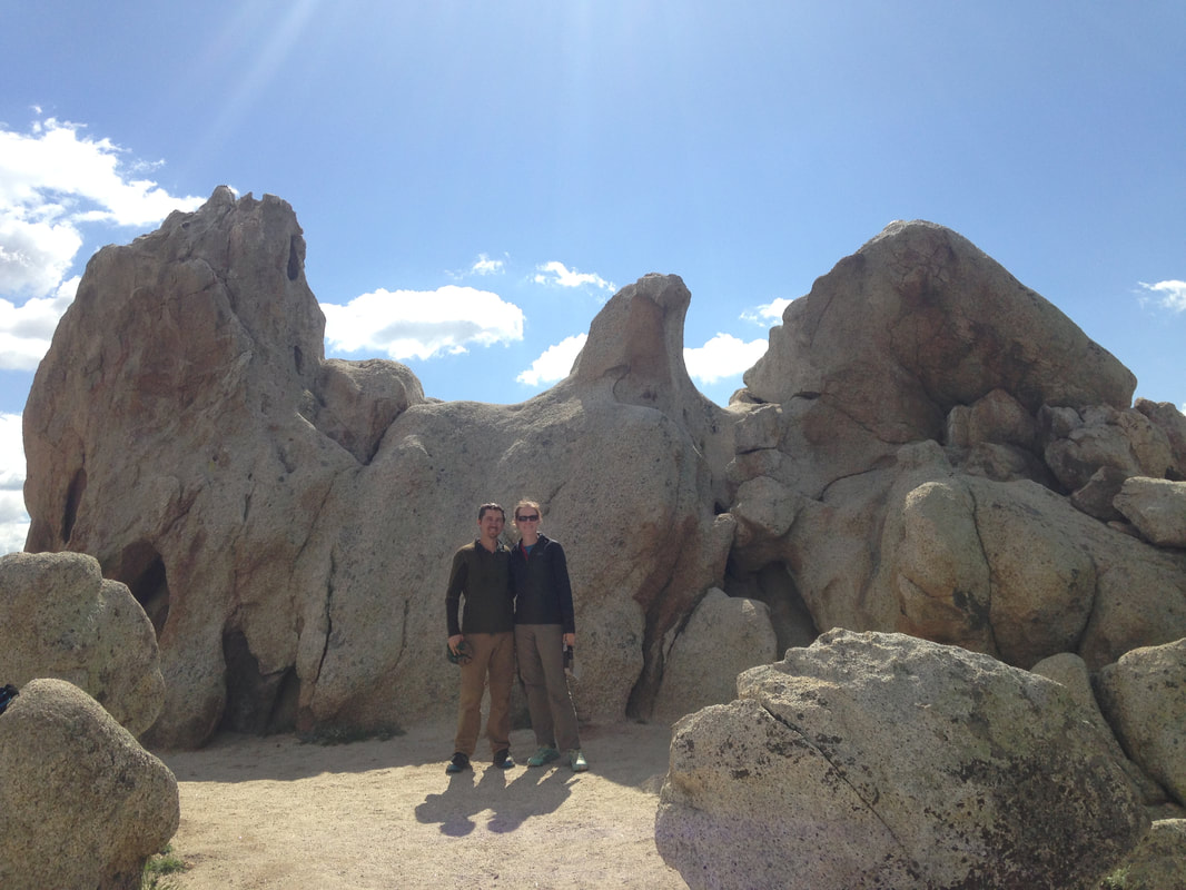 After lunch, more pastureland. Cows lie in the trail like cats on a windowsill, so we hike in the grass instead. Bright orange poppies cluster like constellations and galaxies among the green slopes. 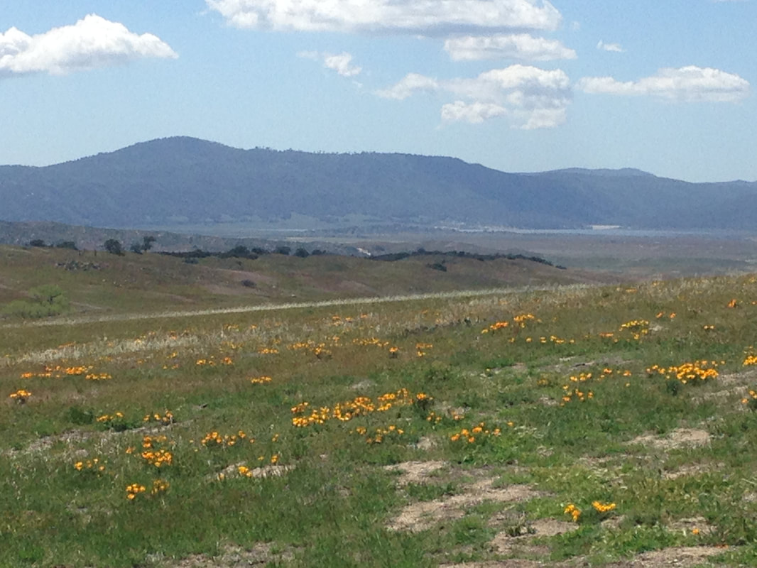 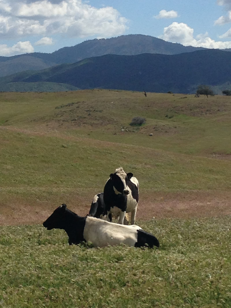 We dip into the canyon of a small creek, and again the scenery changes. What is this, the fifth ecosystem today? We break by the creek and talk to a family out for a five-day section hike. The boy is about ten years old and the girl about twelve, and they tell us they hiked the PCT last year. The parents tell us stories of their experiences in Washington: an open water bottle tipped over in the night and soaked their sleeping bags, a broken femur ended the boy’s hike. They plan to go back this summer and finish the section the boy had to skip.
We hike a little further upstream and find a wide sandy area that extends far enough away from the creek to set up camp. Another hiker we haven’t met sets up camp nearby and we talk briefly. He just finished his military service and is hiking the PCT while he figures out what he wants to do next. Lindsey and I read our books through the evening. We can hear the dispatcher’s announcements from the nearby fire station. We must be closer to town than we thought. We wake up to our phone alarms at 6:30, bleary but rested. We pack our belongings and set a few unnecessary items aside. We have eaten our way to lighter packs, but we’re still carrying more than necessary, and not all of it is food. I am eager to shed pounds, ounces even, and Lindsey follows my example. We drop the items in a hiker box in front of the hotel on our way to breakfast. A few hikers are making their way through the buffet when we arrive. We collect cinnamon rolls, waffles, fruit, deviled eggs, and more. Our plates are overflowing. We both avoid the oatmeal. We join Tars and Cathy at a small table and dig in. Eating fresh food is delightful. We have only been hiking six days, and already the flavors make me pay attention. The honeydew melon is slightly underripe, but I don’t care. The flavors pop into existence suddenly on my tongue, and permeate dark hidden spaces in my mouth where I shouldn’t have taste buds. The sweet cold nectar spreads like energy and cools me. Every bite is like this, not just the melon. Stoicism and asceticism have never been for me, but short periods of denial have always helped me appreciate what I have. I know people who love backpacking for the taste of food after they return. I’m in it for the scenery and adventure, but I will admit that the food is a nice side effect. After seconds, and thirds, we collect our packs and check out. Tars and Cathy still have to pack up, so we leave without them. Besides, we all have to hitch this morning, and it’s easier with two than with four. Since trail angel Ed was waiting to give us a ride into town yesterday, we didn’t have to hitch, so I’m still nervous about catching our first ride. Hitchhiking stories seem to be dominated by psychopaths and criminals. Rationally, I know that’s not true; plenty of people have hitchhiked over the years without problems. It’s just that scary, unusual stories stick. It’s the same reason people worry about bears and mountain lions on the PCT: statistically, you’re more likely to fall to your death than to be attacked, and you’re more likely to be hit by a car than to fall. But mountain lion attacks are more interesting than getting in an accident on the way to work, so those are the stories we remember. Nonetheless, knowing a thing and feeling it are different things, so I’m still nervous to hitchhike. Ed told us to stand across from the Library, so we do. Five or six cars come by, but none of them stop. Most of them turn down a side street before they even get to us. After about ten minutes, a car pulls over and pops the trunk. We hurry over, cram our packs into the small space that’s available, and climb in the back seat. Our driver is a woman in her fifties, and her passenger is her mother. We share the backseat with a pot of petunias. I suppose old ladies with petunias can be psychopathic murderers too, but if I was looking for a way to make my fears seem ridiculous, I couldn’t do better than this. We talk about adventures on the drive: the younger of the two hiked Kilimanjaro with her husband the previous year, and we’re planning that in a couple years, so we have plenty of questions. We arrive at Scissors Crossing—the 4-way junction where we left the PCT—in a snip. After all that conversation, the desert seems especially quiet. The crunch of our shoes in the sandy soil seems to define and amplify the surrounding silence rather than disturb it. Uphill. Turn. Double-back. Double back again. Switchbacks follow the contours of an exposed mountain face for miles. From across the basin, this mountain looked a uniform tan. Up close now, it is teeming with flowers, endless varieties of cactus, and gardens of ocotillo. The desert is easy to malign when you stick to the roads. Get out in it, and it crackles with vibrancy. 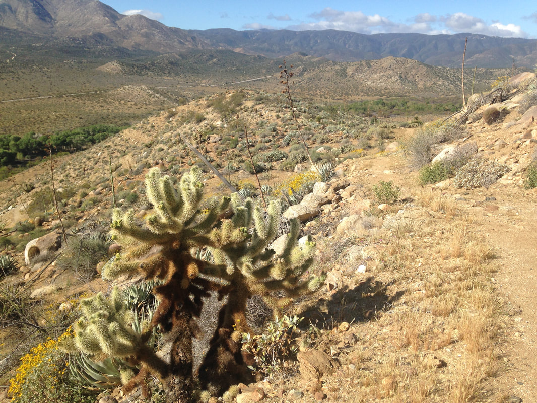 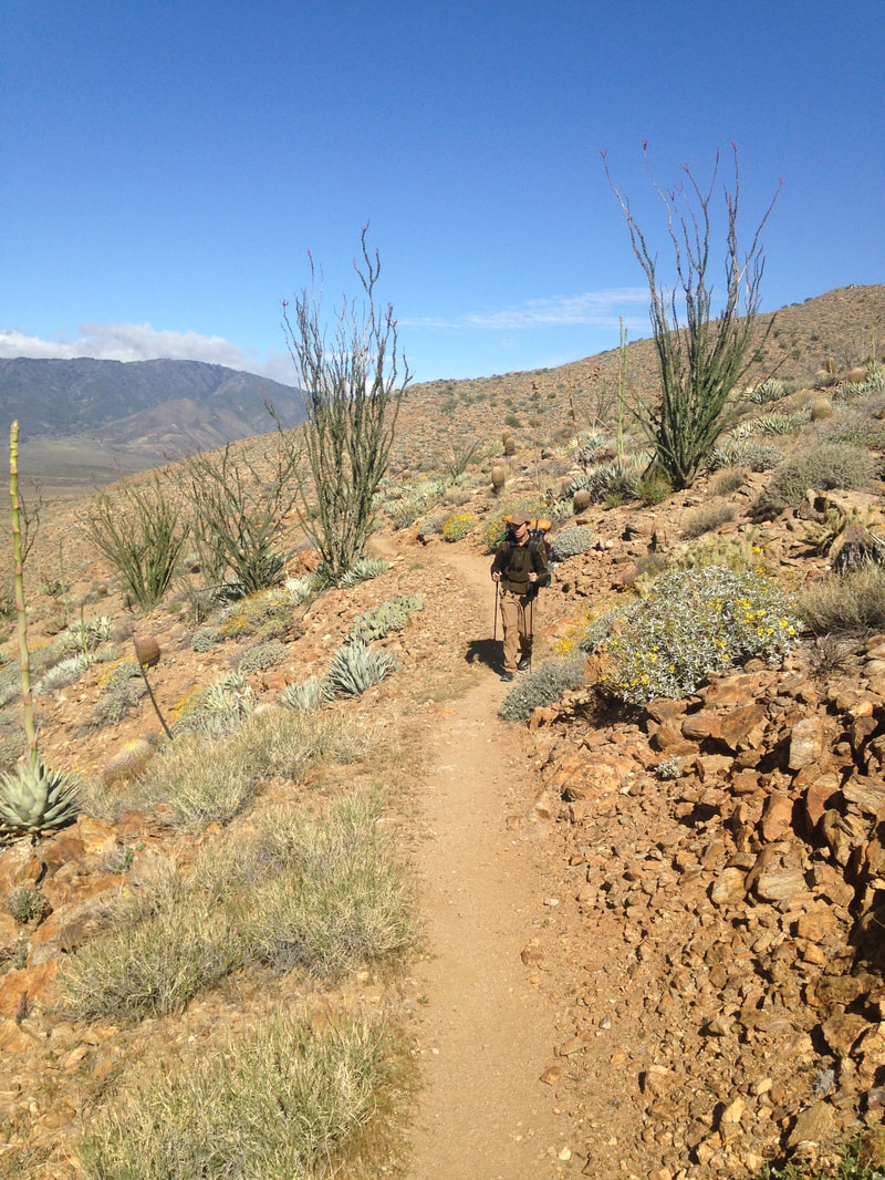 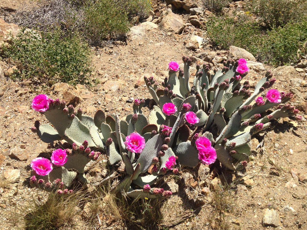 The morning cool shifts into a radiating warmth, and we rest several times. At each stop we review the morning’s climb with a birds-eye view of the basin below. We look for other hikers below, but at this distance, the lower details of the mountain have resolved themselves back into a uniform tan, and any hikers that are out there are indiscernible from other dots that speck the landscape. Two fighter jets streak the basin—loudly—and later, two more. This must be where pilots practice their low-altitude flights. You can escape civilization, but you can’t escape the machine. As we continue up the switchbacks, I reflect on the many systems we have created as human beings: Commerce, social hierarchies, systems of power and law. Every system is a mixed bag, but the one that seems to chafe me most is capitalism, perhaps because it is treated as gospel to so many. I develop a case against it in my head. In a perfect world, price would be determined by value. But humans are imperfect and driven by emotion. You don’t have to look far to see how savvy marketers can turn our own short-term desires and emotions against us. A false scarcity (“for a limited time only!”), sex appeal, illusions of status, these things seduce us all. Of course, every time we’re seduced, the perceived value of the object goes up. On the flip side, those things which don’t tickle our short-term desires are less valued. On a biological level this makes sense—when we have to decide between getting food today and creating social cohesion sometime in the future, we should choose food. But as our fundamental needs are increasingly met, our emotional minds don’t catch up. We continue to buy the fancy car to enhance our sex appeal even after we’ve created offspring. We value the limited time offer—that we don’t need—over the long-term savings plan that will give us security in old age. On an individual level, it’s easy to blame the individual: capitalism isn’t working for him because he lets his emotions overcome his rational mind. A fool and his money are soon parted. But what about on a social level? Much of our safety and security is dependent on social programs: fire, police, military, education. In a completely free market, it’s easy to see how the system could quickly get out of whack. In fact, we see it all the time in insurance markets: people pay for earthquake coverage after an earthquake, when fear of earthquakes is in the front of their mind. Does the value of the coverage go up after an earthquake? If we paid for police in a free market, the police would only protect those people who paid. The police would be able to focus their attention on only those people, and yet, those people would be less safe, because the whole society would descend into chaos. Luckily, we have a government system (also imperfect), that decided that we are all safer if we pay for police protection. The same rationale can be used for fire, education, and the military. But what about those things we leave to the free market? Aren’t we capable of gross perversions in the attribution of value when we leave things in the hands of advertisers? This is what scares me about the school choice movement. When money comes out of public education to fund private schools, it will be the same as if only the rich pay for police protection. Short term gain, long term danger. And what about the way capitalism values entertainment? In the movies, flashy effects and sex appeal are easier to market than deeply crafted stories, and so we are glutted with superheroes that add little to our personal growth, while films that can expand our understanding of the world are relegated to the arthouse. The nightly sportsball games draw billions of dollars to create events that will mostly be forgotten tomorrow, while the orchestras and choirs that keep some of our greatest cultural achievements alive struggle to stay afloat. And of course, how we value the natural world. Capitalism could never create the Pacific Crest Trail, or a national park. In fact, capitalism tries to convert the sublime beauty and richness of the world into resources for consumption. Capitalism isn’t all bad, of course. Much of our technological advancement has come as a direct result of capitalism. But I have to wonder if there’s a better system possible—one that rewards real value, long term value, rather than ephemeral desires. These thoughts take me deep into the afternoon. We pass a pipe gate, which makes a horrible creak as we push it open and pass through. The trail has turned to follow the eastern side of a large valley. Two gates later we find a collection of small tents nestled among the bushes, and a jeep trail goes down to the right. This must be the third gate water cache. Strange that no one is around, with all these tents. We still have plenty of water, so we continue on. 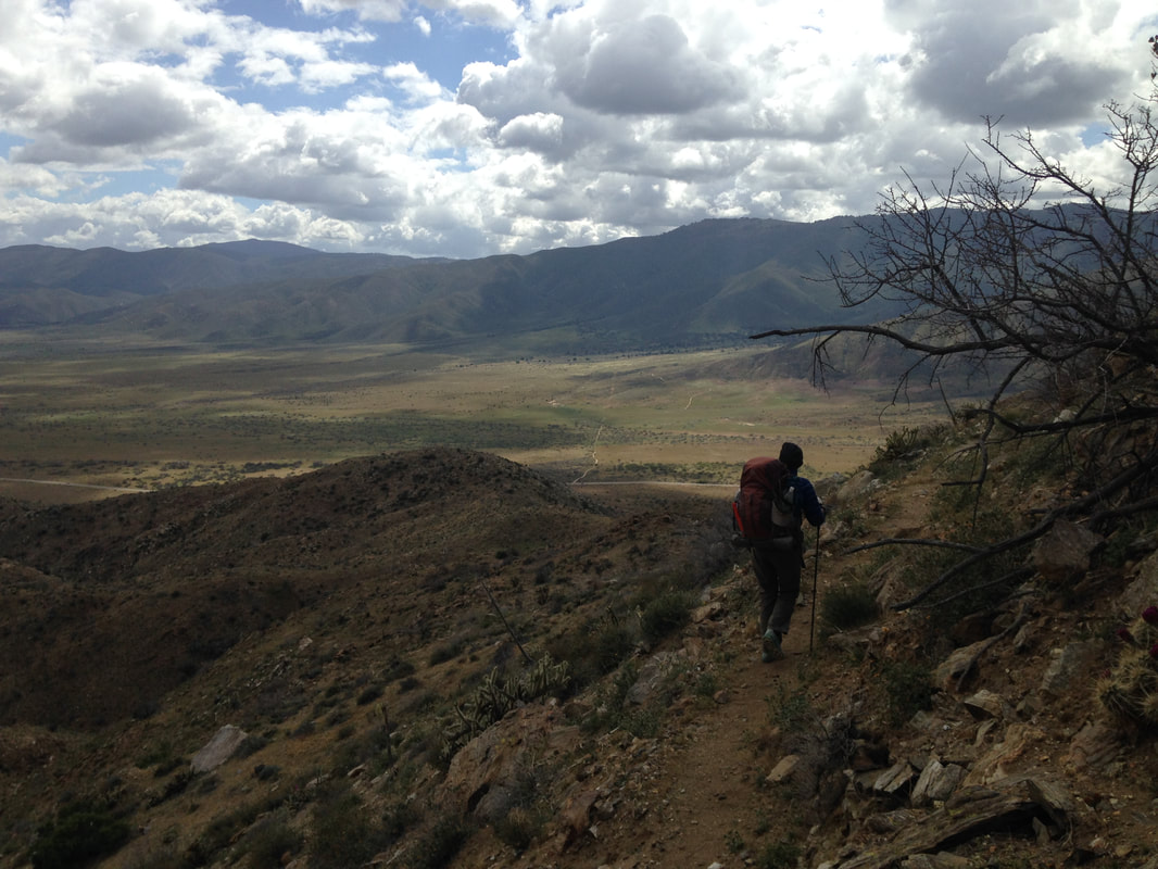 We go through a series of small sandy valleys as we make our way along the top of the large one. The trail often disappears, but other hikers have used their poles to trace the outline of where we should walk. Large, in the middle of one valley, someone has written 6P in the sand. Later, we see it a couple more times, smaller, in the middle of the trail. A few large black clouds, each one distinct, comes over the other side of the valley. Unexpectedly, we are suddenly deluged by rain. The forecast showed sunny and warm all day! We quickly take out our rain jackets, but we have quick-drying pants, so neither of us brought rain pants. This was a mistake. The rain lasts for about a half hour, and by the end we are both soaked and shivering. Note to self: buy rainpants. We set up camp in a cold wind, and a nearby hiker comes over to say hi. His introduces himself as Chuck, and we ask if he has a trail name. He does—6P. We strip off our wet clothes and climb into our sleeping bags for warmth. I read for a bit while Lindsey naps. An hour later we emerge to make dinner, and we are greeted by a spectacular sunset: streaming stripes of sunlight split and splayed by cloudbursts over the valley. 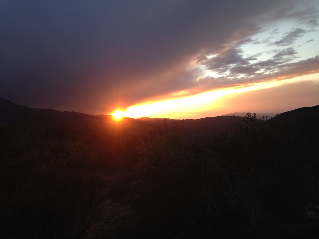 We wake almost as soon as it is light. The area is bustling with other backpackers packing their gear. The few hikers who are still in their tents must be deep sleepers. Lindsey and I are among the first to depart Rodriguez Canyon. A dirt road runs next to the fire tank, and the trail starts up on the other side. It cuts across the side of a stolid, pyramid-like mountain that I am tempted to climb on some future trip. My list of “stuff to see again” is getting longer every day that I’m out here, and I’m less than a hundred miles into this trip. It’s one thing to know rationally that the world is big; it’s another to put your feet on the earth and experience it step by step. What a glorious place we live. The ice showers, or more accurately, sprays, continue in a few gusts as we make our way along the side of the mountain. As we move away from the canyon, I am able to see more of the basin we were camped above. It is an immense triangle. The mountains we are slowly cutting across form the southeast wall, to the north is a light brown range, and the western edge is framed by a taller range that appears a darker brown. Each of the points of the triangle is a valley that stretches beyond view. This is erosion writ large, humble water gently imposing its will on the immensity of earth. 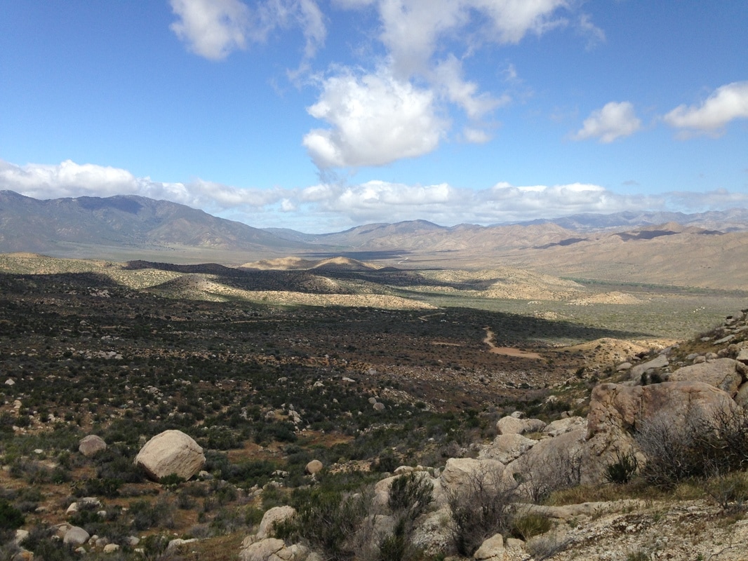 We take our time down the trail and discuss whether we need to end our trip. If we run into another windy night, the tent is doomed; the splint can only be used for one breakage. We’re tired and haven’t slept much for two nights in a row. When we get to a spot with cell service, I call my mom to see if she would even be able to pick us up. She says she can, but it would be late the next day. That’s fine. We can hitch into the town of Julian this afternoon and spend the night in a hotel. The wind is all but gone now. The ice sprays, too. The sun comes out, and a rainbow appears across the distant mountains. It’s looking to be a much nicer day. Between that and the knowledge that we’ll have a safe place to sleep tonight, we both relax and enjoy the hike. Two fighter jets rip through the basin and we track them for ages before they finally disappear. This basin is even larger than it appears. A few hikers pass us one at a time. Tars, Monique, Cathy. I turn my attention to the desert flora, which seems particularly vibrant. Dull grasses and chaparral have mostly disappeared, replaced by yucca, ocotillo, and several varieties of cacti. Everything is blooming, and the juxtapositions between the yellows of the barrel cactus and cholla, the pinks of the prickly pear, and splashes of purple and red from unidentified blooms, are an endless and ever-changing delight. 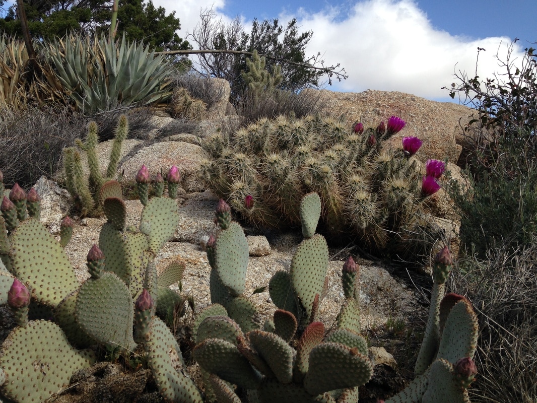 As we continue around the mountain, I can see miles of trail ahead, running a long slow descent northeastward to the basin floor, and then a straight line north to scissors crossing, where four lightly-traveled roads criss-cross before they head off toward distant towns. I tell Lindsey about a story my dad loved to tell, about a man he knew with an award-winning cactus garden (although who goes around giving awards for cactus gardens, I have no idea). People asked him how he was able to create such healthy cactus. His answer: “I read the weather reports in the paper every day. When it rains in the desert, I water my cactus.” Moral: You can’t outdo nature. We pass a mobile home built up on a hill, miles from anything except the trail. A mile or so later, I climb a small ways off trail to collect a mylar balloon that has travelled a long chain of irresponsibility to get here: a manufacturer who no doubt knows the negative impacts on wildlife and chooses to make it anyway; a retailer who chooses profits over responsibility; a fool, perhaps a parent or coworker, who perhaps means well but out of ignorance—or worse—indifference, makes the purchase; a devil who releases it into the air with disregard for the consequences to life. A latex balloon takes from 6 months to 4 years to biodegrade. That’s already an awful burden to put into the wild, but use google to look up the time it takes for a mylar balloon to decompose, and you won’t find a clear answer. That’s because nobody knows. Mylar, which is polyester film covered with a metallic coating, is considered “not biodegradable”. Balloons regularly kill all manner of animals: some mammals and sea turtles will try to eat them and starve to death, and birds and ocean life can get trapped in the ribbons. Please, if you want to celebrate, there are much better alternatives: blow bubbles instead of releasing balloons, give potted plants and flowers. I’ll even subject myself to listen to one of those blasted airhorns if you agree not to release balloons into the ecosystem. We stop several more times on our way down the mountain in order to strip off layers of clothing. The wind is completely gone now, and the heat begins to intensify. By the time we hit the desert floor, it is easily eighty degrees, probably pushing ninety. The trail is still a gentle downhill, but it looks and feels flatter than before. I look for snakes among the cactus and dry bushes, slightly disappointed that I haven’t seen one already, and I begin to wonder how difficult it will be to get a hitch. I’ve never done this before, and I’m a little nervous about it. 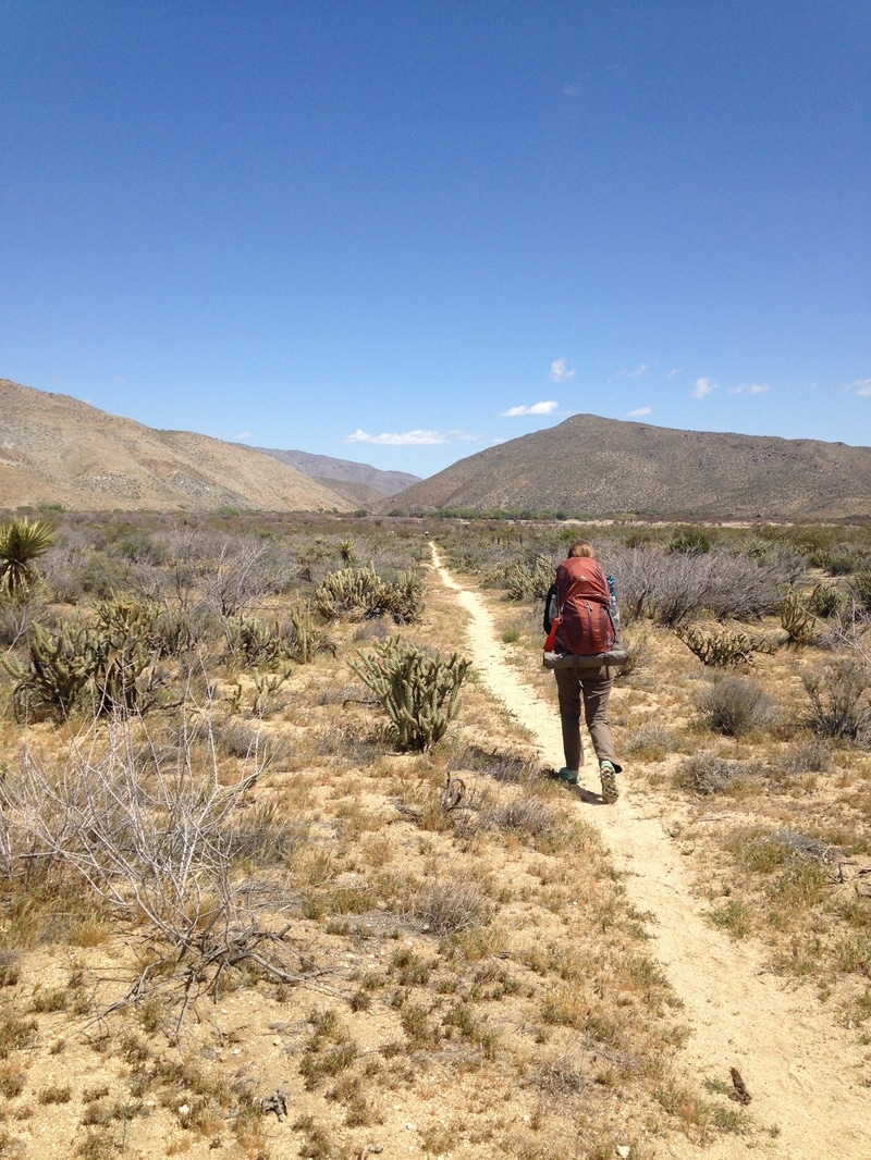 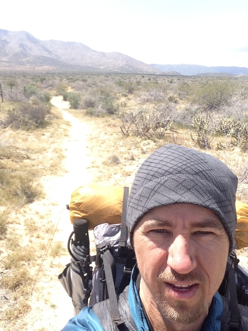 Before we know it we are at the road. Monique and Tars have been there for a few minutes, and Cathy is just taking off her pack. They’re talking with a bearded man who introduces himself as Trail Angel Ed. He offers us cold water and a ride to Julian, and we gladly accept both. It’s several miles to Julian, and we ask Ed about his trail angel experiences. He does this regularly, he says, and enjoys helping out hikers. He also mentions that he’s working on a master’s degree and is writing a research paper about PCT hikers. When we arrive in town, Ed points out several hiker-friendly spots and gives us advice on where to eat and stay. We all opt to check in to the Julian Lodge. Lindsey and I shower and wash our laundry in the bathtub and sink. A wagonload of dirt comes out of our clothes and gear. It’s like a magic trick—I don’t know where it could have been hiding! It takes us a good forty-five minutes just to clean it all up. We go out for food at the Miner Diner—it’s strange to be around normal people again—, then for a beer at Buffalo Bill’s, and finally to “Mom’s” for some famous apple pie a la mode. We opt out of the apple and choose strawberry rhubarb instead. It's a good choice. 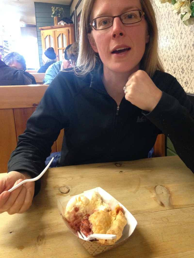 The two girls from the first day (we learn their names are Haven and Kristen) are sitting with another girl, who I don’t recognize. They have skipped ahead from Mt. Laguna because of the wind. We tell them our horror stories from the wind. It takes me about 15 minutes of sitting and talking with them before I realize that the third girl is Cathy. After a shower and with her hair down, she looks like a completely different person.
Lindsey and I go back to our room and read our books until it gets dark. We look at the weather for the next few days. Low 80s, no wind, no rain. We talk it through and then call my mom: Never mind about the ride, we’re going to continue hiking. Packing the tent is nerve-racking: at any second I feel like the wind might blow it out of my hands and far down the mountain. Lindsey and I grit ourselves and wrestle it into the bag. The tent is a Big Agnes Fly Creek UL 2, which is basically a lopsided tripod, with a long center pole running the length of the tent and two shorter poles framing the door. The design is lightweight, but it shapes the fabric into a sail which catches every last bit of wind. Throughout the night, each gust would catch the sail and whip the center pole to one side or the other. If the noise of the wind hadn’t already woken us, the center pole would wake us when it whacked our feet. We are tired. The trail is a long, gradual downhill following the contours of erosion: big loops around the right with sharp incursions to the left at each empty stream. At the first of these, a set of four tents has set up inside the wash, and a couple hikers are huddled around camp stoves making breakfast. The chapparral is waist-high and affords us long views of layered mountains to the east. Conversation is impossible over the constant whine of the wind.  We continue on like this for a few miles, eventually hopscotching with the group of hikers we passed that morning and another pair of couples who hike fast. At one break, Lindsey tells me that her knee hurts. The constant downhill and fast pace are an unkind combination on the joints. We should go slower, but the constant wind seems to always drive us to a faster pace, as if we could out-hike it. Our next water source is off a side-trail about a quarter mile. I tell Lindsey she can rest her knee for a bit while I go get water, but she doesn’t want to just sit and wait for me, so we decide that I’ll hurry to the water and start pumping while she hikes in that direction, and she can meet me there so I don’t have to carry 10 liters back by myself. Now we are hiking directly into the wind. I quickly notice that we had been protected from the worst of it as we hiked along the side of the mountain, and now it is unobstructed. For the first time on this trip, I am truly miserable. I get to the water tank, which is just across a road, and find instructions painted on a rock on how to access the water. It is like a puzzle: first, turn the handle three-quarters turn to the left. Then, lift the metal gate. Pull the handle and wait for the water to go through the chute. I fill the bucket and sit down behind the water tank for some relief from the wind. On the first attempt to fill my filter bag, the wind hits the cloth bucket and I spill about a liter down the leg of my pants. Lindsey arrives a little while later, before I have finished filtering. Her face is twisted in misery. When she gets to me, she starts to cry. The tears stream sideways on her cheeks as the compassionless wind refuses to relent. I wrap her in my arms and think that this is not what I wanted from our first backpacking trip. She only cries for a moment—it’s all she needs, and then she is strong again, and I am proud of her resilience. We sit together and finish pumping the water. There is a parking area with pit toilets nearby, and we go to use the restroom, where I experience an exciting wind enema. We take a break from the wind by sitting inside one of the bathrooms while we eat snacks. Luckily, it’s one of the cleaner pit toilets I’ve seen, and there seems to be none of the odor that usually accompanies such a place. Perhaps the wind has done us this one favor. Rested, we continue onward, and finally—finally!—we get to a valley. The wind disappears within an hour. The climb down is steep, and we have to go slow for Lindsey’s knee. A couple of hikers come by, one at a time, and we talk with each of them. One girl tells us that she actually made lunch in one of the pit toilets. 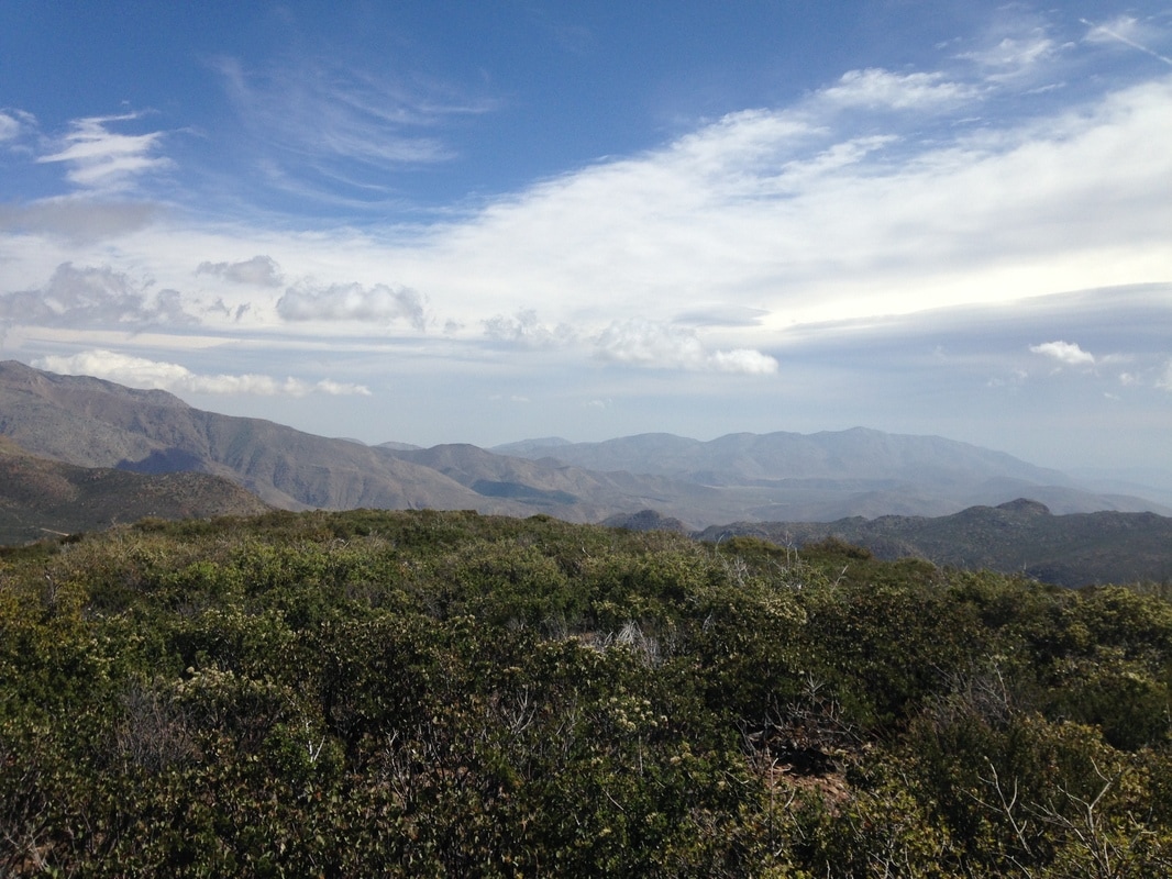 It gets very hot in the bottom of the canyon. Someone has left a water cache where the trail crosses a jeep trail, but the bottles are all empty and now it’s just trash. I sure hope someone is coming back to pick it up. The jeep trail and surrounding desert vegetation—and probably the trash, too—reminds me of childhood trips to Baja Mexico. What goes down must come back up, and soon we face a steep climb up the other side of the valley. No sooner do we emerge than the wind comes back, but now it has segmented itself into huge sudden gusts that push us off the trail and into the grasses and small bushes on either side.  We continue to meet, pass, and be passed by the same eight hikers. We find out that the two couples are hiking as a group, but the other four are all solo hikers who just happened to camp together last night. One of them tells us that if we can make it to the Rodriguez Canyon Fire Tank, there should be some protection from the wind. That’s only a few miles from here, and we have hours of daylight left. We make our way up, along, and over a ridge line, stumbling off-trail and back with each new gust. It’s slow going. 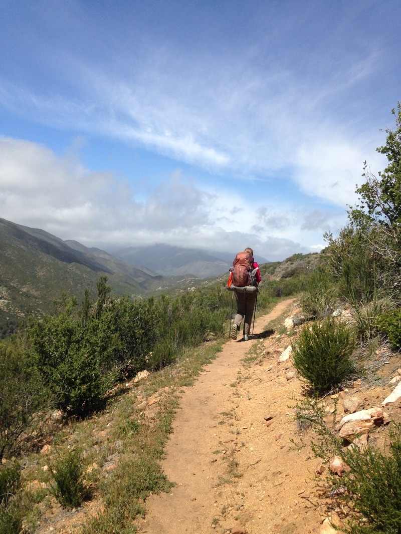 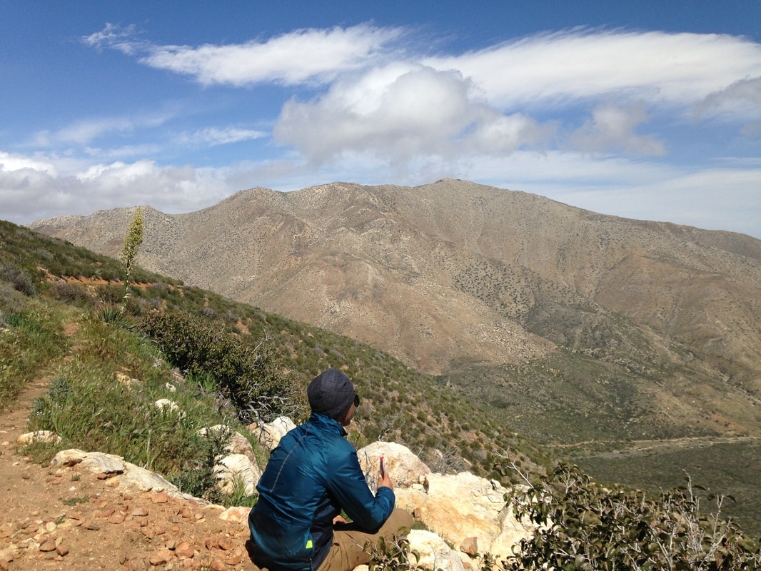 The trail turns downhill, and the wind is a little less violent. We are still knocked off-trail, but it happens a little less often now. We arrive at the fire tank, nestled where the canyon overlooks a huge open valley at least 10 miles across, and find that there are already about 14 hikers here. But no problem, there are still plenty of sites. Several are between large bushes, but those have all been taken. Our only choice seems to be a flat open area with a few other tents, so choose a spot next to Cathy, the hiker who told us she had made lunch in the bathrooms earlier in the day. We chat as we set up our tents, still fighting with the wind. It’s mostly calm now, but when the gusts come through they seem stronger. You can actually watch them come across the mountain slopes, like invisible boulders flattening all the grass and violently shaking all the bushes. There are also occasional sprays of rain and ice whipping down with the gusts. This is ridiculous. Cathy tells us she’s worried that the wind might break her tent, which is also a Big Agnes. I tell her about the previous night and how well the tent held up. I tell her not to worry, it’ll be fine. She is less worried, and walks down to the fire tank to fill up with water. Our tent is up, and we start to put up the rainfly, when a gust flattens the whole thing to the ground. When it pops back up a moment later, a broken pole is sticking straight up through the rainfly. Shit. Lindsey looks to me to see what we should do, and I think she can see the panic in my eyes, because a moment later, I see it reflected back. It takes me a minute, but I pull myself back under control and start thinking about options. I remember the tent pole splint, which I almost discarded in order to save carrying a couple ounces. Now I’m glad I brought it. If this doesn’t work, we can use the rain fly as a tarp tied to some bushes to keep the rain and ice off us. The night will be rough, but we’ll be okay. I tell Lindsey our options, and she’s still distressed, but I can tell she feels better. We look for other places to set up. We try setting up behind a large bush in an otherwise open field. It doesn’t matter. The gusts are coming from all directions and we can barely set up the tent. Finally we settle on a narrow opening surrounded on three sides by bushes. We will have to climb through the bushes to get to our tent, but hopefully it will provide some protection from the wind. We get set up (the splint works!), make dinner behind the fire tank (which may or may not provide some protection), and climb into bed. We sleep erratically, in short bursts: we hear gusts coming down the mountainside, and we both reach up and stabilize the tent as it shakes. Around three or four in the morning, the gusts become gradually less violent and spaced farther apart, and we finally get a little sleep. 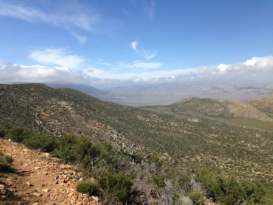  |
Author
Nick is a teacher, writer, and amateur adventurer. Archives
June 2020
Categories |
 RSS Feed
